|
search place name
|
||
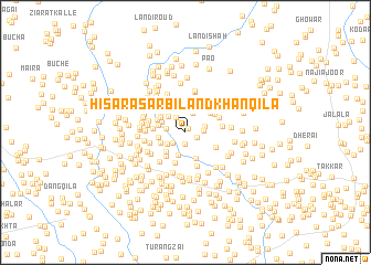
Hisāra Sarbiland Khan Qila (North-West Frontier, Pakistan)Hisāra Sarbiland Khan Qila is a town in the North-West Frontier region of Pakistan. An overview map of the region around Hisāra Sarbiland Khan Qila is displayed below.
regional and 3d topo map of Hisāra Sarbiland Khan Qila, Pakistan ::
Hisāra Sarbiland Khan Qila airports ::
The nearest airport is PEW - Peshawar Intl, located 43.7 km south west of Hisāra Sarbiland Khan Qila.
Other airports nearby include SDT - Saidu Sharif (76.3 km north east), JAA - Jalalabad (116.7 km west), ISB - Islamabad Chaklala (146.5 km south east), MFG - Muzaffarabad (160.6 km east), Nearby towns ::
Kāgān (0.5km north east) //
Hisāra Hasan Ali Qila (1.1km south) //
Hisāra Zahūruddīn Korūna (1.1km south east) //
Sardār Korūna (1.4km south west) //
Muhammadji Korūna (1.6km north west) //
Shāh Said Korūna (1.5km east) //
Ajārā Kalle (1.6km west) //
Āhingar Kili (1.7km east) //
Hāji Korūna (2.1km north) //
Miān Ismatullāh Kalle (1.9km south west) //
Shāh Ālam Korūna (2.2km north) //
Banor Shāh (2.3km south) //
Yār Khān Korūna (2.2km north west) //
Dādu Kalle (2.2km north west) //
Shergul Kili (2.5km south west) //
Mīr Ālam Kalle (2.3km west) //
Nāsāpal (2.6km north east) //
Daulat Khān Kili (2.4km south west) //
Dakai (2.8km south) //
Darub Nāe Kalle (2.4km west) //
Wazīr Kaka Kalle (2.5km north west) //
Dheri Kalle (2.6km north west) //
Khāt Kalle (2.9km south west) //
Mandna (2.8km north east) //
Jānān Korūna (3.1km north) //
Ghunda Khel (3.2km south) //
Akbar Khān Kalle (2.9km north west) //
Hindu Kalle (2.7km west) //
Bājāwara Kalle (3.1km north west) //
[all distances 'as the bird flies' and approximate] 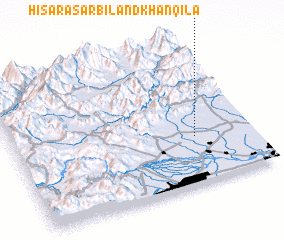 Places with similar names to Hisāra Sarbiland Khan Qila, Pakistan :: Disclaimer :: Information on this page comes without warranty of any kind |
||
|
Where is Hisāra Sarbiland Khan Qila? Elevation and coordinates ::
Latitude (lat): 34°19'43"N Longitude (lon): 71°45'50"E
Elevation (approx.): 383m (map arrows pan, magnifying glasses zoom) |
||
|
Visiting Hisāra Sarbiland Khan Qila? Hotel/Accommodation ::
Book a hotel in Hisāra Sarbiland Khan Qila Travel Guide ::
Buy a travel guide for Pakistan rental cars ::
car rental offers GPS waypoint ::
download a GPX waypoint (PoI) of Hisāra Sarbiland Khan Qila for your GPS receiver
|
||