|
search place name
|
||
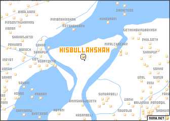
Hisbullāh Shāh (Sind, Pakistan)Hisbullāh Shāh is a town in the Sind region of Pakistan. An overview map of the region around Hisbullāh Shāh is displayed below.
regional and 3d topo map of Hisbullāh Shāh, Pakistan ::
Hisbullāh Shāh airports ::
The nearest airport is SKZ - Sukkur, located 30.1 km south west of Hisbullāh Shāh.
Other airports nearby include SUL - Sui (80.5 km north), MJD - Moenjodaro (105.8 km south west), RYK - Rahim Yar Khan Sheikh Zayed (137.6 km east), WNS - Nawabshah (199.3 km south), Nearby towns ::
Amal Goth (5.9km west) //
Ābād Mehlāni (6.2km west) //
Kot Shāhgarh (7.1km north) //
Miral Chāchar (6.7km north east) //
Goth Miān Amānullāh (7.1km east) //
Goth Faqīr (7.2km east) //
Goth Mohāna (7.3km east) //
Chiman Sukhpur (7.5km west) //
Adar Tokya (7.4km west) //
Jango (9.3km south) //
Pīr Ibrāhīm Shāh (9.2km north west) //
Alāhna (9.5km south east) //
Muhro Māri (9.5km north east) //
Sundar Beli (9.5km south east) //
[all distances 'as the bird flies' and approximate]  Places with similar names to Hisbullāh Shāh, Pakistan :: Disclaimer :: Information on this page comes without warranty of any kind |
||
|
Where is Hisbullāh Shāh? Elevation and coordinates ::
Latitude (lat): 27°56'30"N Longitude (lon): 68°58'15"E
Elevation (approx.): 65m (map arrows pan, magnifying glasses zoom) |
||
|
Visiting Hisbullāh Shāh? Hotel/Accommodation ::
Book a hotel in Hisbullāh Shāh Travel Guide ::
Buy a travel guide for Pakistan rental cars ::
car rental offers GPS waypoint ::
download a GPX waypoint (PoI) of Hisbullāh Shāh for your GPS receiver
|
||