|
search place name
|
||
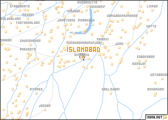
Islāmābād (Sind, Pakistan)Islāmābād is a town in the Sind region of Pakistan. An overview map of the region around Islāmābād is displayed below.
regional and 3d topo map of Islāmābād, Pakistan ::
Islāmābād airports ::
The nearest airport is RYK - Rahim Yar Khan Sheikh Zayed, located 77.1 km north east of Islāmābād.
Other airports nearby include SUL - Sui (81.7 km north west), SKZ - Sukkur (87.2 km west), MJD - Moenjodaro (163.5 km south west), JSA - Jaisalmer (175.9 km south east), Nearby towns ::
Dino Maku (0.5km north west) //
Jālbāni (1.0km east) //
Abdul Khair Logur (1.6km south) //
Sachal Khān (1.7km south) //
Masu Maku (2.2km south east) //
Allāhābād (2.1km west) //
Nūr Muhammad Punjābi (2.9km north) //
Wāhid Bakhsh Kalwār (3.0km west) //
Nāokot (3.6km north east) //
Khairābad (3.4km east) //
Said Khān Chāndio (3.4km west) //
Lāl Bakhsh Kalwar (3.8km west) //
Goth Jhande Bughe (4.0km east) //
Syed Rasūl Shāh (4.1km west) //
Goth Mīr Hassan Khiri (4.3km east) //
Wariām Unar (4.5km north west) //
Īslām Lashāri (4.6km north west) //
Kalu Khān Siāl (4.5km west) //
Faqu Kalāchi (4.8km north west) //
Muhammad Sādiq Kalwar (4.8km west) //
Jahān Khān Unar (4.9km north west) //
Goth Bago Bhutto (5.1km north east) //
Goth Nathu Bhutto (5.1km north east) //
Rahirki (5.2km north east) //
Khatiān (5.0km west) //
Kotia Mirzan (5.2km north east) //
Darya Khān (5.2km west) //
Goth Jān Muhammad Faqīr (5.2km east) //
Hoyāt Magsi (5.3km west) //
[all distances 'as the bird flies' and approximate]  Places with similar names to Islāmābād, Pakistan ::
Disclaimer :: Information on this page comes without warranty of any kind |
||
|
Where is Islāmābād? Elevation and coordinates ::
Latitude (lat): 28°1'0"N Longitude (lon): 69°36'45"E
Elevation (approx.): 70m (map arrows pan, magnifying glasses zoom) |
||
|
Visiting Islāmābād? Hotel/Accommodation ::
Book a hotel in Islāmābād Travel Guide ::
Buy a travel guide for Pakistan rental cars ::
car rental offers GPS waypoint ::
download a GPX waypoint (PoI) of Islāmābād for your GPS receiver
|
||