|
search place name
|
||
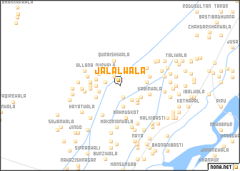
Jalālwāla (Punjab, Pakistan)Jalālwāla is a town in the Punjab region of Pakistan. An overview map of the region around Jalālwāla is displayed below.
regional and 3d topo map of Jalālwāla, Pakistan ::
Jalālwāla airports ::
The nearest airport is MUX - Multan Intl, located 95.6 km south west of Jalālwāla.
Other airports nearby include LYP - Faisalabad Intl (114.3 km north east), Nearby towns ::
Pindiwāla (1.6km north west) //
Langarwāla (1.9km south) //
Nūrewāla (2.0km west) //
Dhoriwāla (2.8km south east) //
Sohbewāla (3.3km south) //
Nūrwāla (3.1km north west) //
Sherwāla (2.9km west) //
Sharifābād (3.3km south east) //
Fairānwāla (3.2km west) //
Tānda (3.3km south east) //
Qubba (3.3km north west) //
Pīrānwāla (3.3km west) //
Dāra (3.3km west) //
Quraishiwāla (3.9km north) //
Pichhāwrewāla (3.7km south east) //
Jajjānwāla (3.7km south west) //
Jandiānwāla (3.6km east) //
Murādwāla (4.0km west) //
Rājewāla (4.0km west) //
Dauluāna (4.0km west) //
Kabīrwāla (4.2km east) //
Siālāwāla (4.2km east) //
Charhoewāla (4.5km north east) //
Mahmūd Kot (5.2km south) //
Retrīwāla (4.6km west) //
Hadwāla (5.2km south west) //
Ahmadwāla (4.9km west) //
Allāna (5.3km north west) //
Sarinwāla (5.2km west) //
[all distances 'as the bird flies' and approximate] 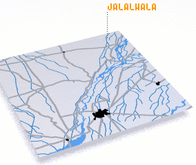 Places with similar names to Jalālwāla, Pakistan ::
// Jalālīwāla (PK)
// Jalāliwāla (PK)
// Jalālwāla (PK)
// Jalālwāla (PK)
// Jalālwāla (PK)
// Jalālwāli (PK)
Disclaimer :: Information on this page comes without warranty of any kind |
||
|
Where is Jalālwāla? Elevation and coordinates ::
Latitude (lat): 30°57'45"N Longitude (lon): 71°53'30"E
Elevation (approx.): 141m (map arrows pan, magnifying glasses zoom) |
||
|
Visiting Jalālwāla? Hotel/Accommodation ::
Book a hotel in Jalālwāla Travel Guide ::
Buy a travel guide for Pakistan rental cars ::
car rental offers GPS waypoint ::
download a GPX waypoint (PoI) of Jalālwāla for your GPS receiver
|
||