|
search place name
|
||
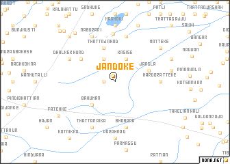
Jandoke (Punjab, Pakistan)Jandoke is a town in the Punjab region of Pakistan. An overview map of the region around Jandoke is displayed below.
regional and 3d topo map of Jandoke, Pakistan ::
Jandoke airports ::
The nearest airport is LYP - Faisalabad Intl, located 73.8 km south west of Jandoke.
Other airports nearby include LHE - Lahore Allama Iqbal Intl (105.5 km south east), ATQ - Amritsar (134.6 km east), IXJ - Jammu (159.2 km north east), ISB - Islamabad Chaklala (188.8 km north), Nearby towns ::
Huseke (1.6km west) //
Kasise (4.0km north east) //
Garhi Wahāb (4.0km north west) //
Bahūmān (4.9km south west) //
Jāngla (5.1km east) //
Thatta Jahād (5.8km north) //
Dhalke Kalān (6.0km north west) //
Hardo Ratteke (6.3km east) //
Bhobāra (7.6km south) //
Madhora Kalān (7.6km north) //
Dhayan (7.9km north) //
Thatta Rāika (8.1km south west) //
Nābu Rāri (8.1km north west) //
Dhalke Khurd (7.3km north west) //
Matteke (8.4km north east) //
Chāh Bhattiān (9.7km north west) //
Tāhli Gurāya (9.7km north west) //
Chak Bahmanowāla (10.9km north west) //
[all distances 'as the bird flies' and approximate] 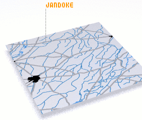 Places with similar names to Jandoke, Pakistan ::
Disclaimer :: Information on this page comes without warranty of any kind |
||
|
Where is Jandoke? Elevation and coordinates ::
Latitude (lat): 31°56'0"N Longitude (lon): 73°24'0"E
Elevation (approx.): 197m (map arrows pan, magnifying glasses zoom) |
||
|
Visiting Jandoke? Hotel/Accommodation ::
Book a hotel in Jandoke Travel Guide ::
Buy a travel guide for Pakistan rental cars ::
car rental offers GPS waypoint ::
download a GPX waypoint (PoI) of Jandoke for your GPS receiver
|
||