|
search place name
|
||
Jān Muhammad Wadero (Sind, Pakistan)Jān Muhammad Wadero is a town in the Sind region of Pakistan. An overview map of the region around Jān Muhammad Wadero is displayed below.
regional and 3d topo map of Jān Muhammad Wadero, Pakistan ::

Jān Muhammad Wadero airports ::
The nearest airport is BDN - Talhar, located 58.3 km west of Jān Muhammad Wadero.
Other airports nearby include WNS - Nawabshah (174.7 km north west), BHJ - Bhuj (184.8 km south), IXY - Kandla (214.3 km south), JSA - Jaisalmer (260.8 km north east), Nearby towns ::
Ali Muhammad Otho (0.6km south) //
Jānu Otho (0.8km south) //
Rāis Rasūl Bakhsh (1.9km south east) //
Piyāro Khān Gorgich (2.0km east) //
Chirāgh Muhājir (2.5km south east) //
Khān Muhammad Thahīm (2.9km north west) //
Goth Hāji Ādam (3.2km south) //
Punnun Kishkori (3.8km north) //
Siddiq Muhammad Tangri (4.1km north east) //
Saīd Khān Jamāli (4.2km west) //
Faqīr Faiz Muhammad Bilālāni (4.2km east) //
Faqīr Siddīq Muhammad (4.6km south west) //
Goth Fateh Ali Khān (4.9km south east) //
Deh Three Hundred Sixty-eight A (5.1km north west) //
Goth Chaudhri Mustafa (5.3km south) //
Hāji Ahmad Amdāni (4.8km west) //
Goth Abdul Ghani (5.5km south) //
Goth Ghulām Rasūl (5.6km south) //
Malūk Tangri (5.3km north east) //
Ahmadābād (5.5km north west) //
Goth Dodo Gorgich (5.3km east) //
Goth Nārāin Dās (5.8km north west) //
Fazal Bhambhro (6.2km south east) //
Said Khān Lighāri (6.3km north west) //
Goth Wadal Shāh (6.3km south west) //
Nusratābād (6.5km south east) //
Goth Muhammad Ali Shāh (6.3km south west) //
Latīfnagar (6.3km east) //
Sher Muhammad Laghāri (6.8km north east) //
[all distances 'as the bird flies' and approximate] 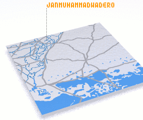 Places with similar names to Jān Muhammad Wadero, Pakistan :: Disclaimer :: Information on this page comes without warranty of any kind |
||
|
Where is Jān Muhammad Wadero? Elevation and coordinates ::
Latitude (lat): 24°56'20"N Longitude (lon): 69°24'20"E
Elevation (approx.): 9m (map arrows pan, magnifying glasses zoom) |
||
|
Visiting Jān Muhammad Wadero? Hotel/Accommodation ::
Book a hotel in Jān Muhammad Wadero Travel Guide ::
Buy a travel guide for Pakistan rental cars ::
car rental offers GPS waypoint ::
download a GPX waypoint (PoI) of Jān Muhammad Wadero for your GPS receiver
|
||