|
search place name
|
||
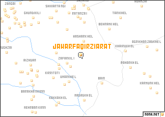
Jawar Faqīr Ziārat (North-West Frontier, Pakistan)Jawar Faqīr Ziārat is a town in the North-West Frontier region of Pakistan. An overview map of the region around Jawar Faqīr Ziārat is displayed below.
regional and 3d topo map of Jawar Faqīr Ziārat, Pakistan ::
Jawar Faqīr Ziārat airports ::
The nearest airport is PZH - Zhob, located 162.1 km south west of Jawar Faqīr Ziārat.
Other airports nearby include PEW - Peshawar Intl (188.9 km north east), JAA - Jalalabad (209.6 km north), Nearby towns ::
Ahmad Shāh Khel (3.0km south west) //
Zafar Kili (3.1km west) //
Washar Khel (3.9km north) //
Qalandar Khel (4.7km west) //
Malla Khel (5.0km south west) //
Azam Shāh Kili (5.2km west) //
Umar Khel (6.0km south west) //
Bain (6.8km south east) //
Bālu Khel (6.9km south west) //
Purshai Mei (7.3km north west) //
Kirri Toti (7.1km south west) //
Khān Khelān (8.3km north) //
Behrām Khel (8.5km north east) //
Owobizhai Ghundai (9.6km north west) //
[all distances 'as the bird flies' and approximate]  Places with similar names to Jawar Faqīr Ziārat, Pakistan :: Disclaimer :: Information on this page comes without warranty of any kind |
||
|
Where is Jawar Faqīr Ziārat? Elevation and coordinates ::
Latitude (lat): 32°30'36"N Longitude (lon): 70°31'10"E
Elevation (approx.): 347m (map arrows pan, magnifying glasses zoom) |
||
|
Visiting Jawar Faqīr Ziārat? Hotel/Accommodation ::
Book a hotel in Jawar Faqīr Ziārat Travel Guide ::
Buy a travel guide for Pakistan rental cars ::
car rental offers GPS waypoint ::
download a GPX waypoint (PoI) of Jawar Faqīr Ziārat for your GPS receiver
|
||