|
search place name
|
||
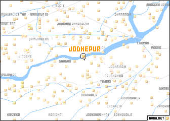
Jodhepur (Punjab, Pakistan)Jodhepur is a town in the Punjab region of Pakistan. An overview map of the region around Jodhepur is displayed below.
regional and 3d topo map of Jodhepur, Pakistan ::
Jodhepur airports ::
The nearest airport is LYP - Faisalabad Intl, located 135.5 km north west of Jodhepur.
Other airports nearby include LHE - Lahore Allama Iqbal Intl (145.4 km north east), ATQ - Amritsar (181.9 km north east), IXP - Pathankot (276.2 km north east), Nearby towns ::
Dalelke (0.6km north) //
Dūna (1.3km south east) //
Mohar Singh Mahtam (1.9km north east) //
Sat Kartār (2.0km west) //
Mohar Singh Dūna (2.1km north east) //
Lāla Har Kishan (2.4km south) //
Lāla Bishan Dās (3.1km south) //
Darkhān (2.8km south east) //
Bondi (3.4km south) //
Bondi (3.4km south) //
Basti Fīroz Muhammad (3.1km east) //
Lāla Amar Singh (3.4km south east) //
Basti Sāruān (3.2km east) //
Nasīrpur Sharīfān (3.7km south) //
Nasīrpur (3.9km south) //
Mohanwāla (4.0km north) //
Sandhu (3.8km west) //
Darājke (3.9km north east) //
Naththuke (4.5km north) //
Qalandarwāla (5.1km south) //
Tola (5.1km north) //
Nazarkot (5.3km north) //
Abdālke (5.3km north west) //
Mohanwāla (5.3km north west) //
Langarke (5.6km north east) //
Mathīla Bāre (5.0km east) //
Chhanna Āzam (5.5km south west) //
Nūr Shāh (5.9km north west) //
Shahnshāh (5.4km south east) //
[all distances 'as the bird flies' and approximate]  Places with similar names to Jodhepur, Pakistan :: Disclaimer :: Information on this page comes without warranty of any kind |
||
|
Where is Jodhepur? Elevation and coordinates ::
Latitude (lat): 30°20'5"N Longitude (lon): 73°45'25"E
Elevation (approx.): 170m (map arrows pan, magnifying glasses zoom) |
||
|
Visiting Jodhepur? Hotel/Accommodation ::
Book a hotel in Jodhepur Travel Guide ::
Buy a travel guide for Pakistan rental cars ::
car rental offers GPS waypoint ::
download a GPX waypoint (PoI) of Jodhepur for your GPS receiver
|
||