|
search place name
|
||
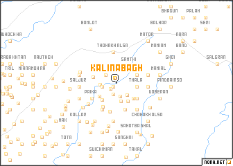
Kāli na Bāgh (Islāmābād, Pakistan)Kāli na Bāgh is a town in the Islāmābād region of Pakistan. An overview map of the region around Kāli na Bāgh is displayed below.
regional and 3d topo map of Kāli na Bāgh, Pakistan ::
Kāli na Bāgh airports ::
The nearest airport is ISB - Islamabad Chaklala, located 35.3 km north west of Kāli na Bāgh.
Other airports nearby include RAZ - Rawala Kot Rawalakot (53.6 km north east), MFG - Muzaffarabad (96.4 km north), SXR - Srinagar (136.4 km north east), IXJ - Jammu (156.9 km south east), Nearby towns ::
Sāhi (0.7km south west) //
Phagwāri Gala (0.7km south west) //
Nawa Shah (1.2km south west) //
Lotwā (1.9km south) //
Mawa (1.9km north west) //
Chakrā (2.2km south) //
Palākhar (2.0km west) //
Gūrha (2.5km south east) //
Gaureān na Mohra (2.2km west) //
Dheri (3.0km south) //
Thala (2.8km east) //
Tālu na Mohra (3.3km south east) //
Dodehli (3.0km north east) //
Khalabat (3.2km south west) //
Sāmthi (3.3km north east) //
Gujaran na Mohra (3.4km south west) //
Shāi Mehr Ali (3.4km south east) //
Karam Singh (3.2km west) //
Palāla Saiyidān (3.7km south east) //
Bhāi Mehr Ali (3.7km south east) //
Khablain na Mohra (4.3km south west) //
Dhamāli (4.5km south) //
Paika (4.2km south west) //
Chak Mirza (4.7km south) //
Jochha Mamdot (4.7km south west) //
Thoha Khālsa (5.0km north) //
Sakot (4.3km east) //
Saintha (4.3km east) //
Khel (4.4km east) //
[all distances 'as the bird flies' and approximate] 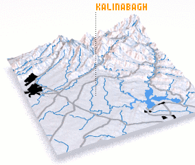 Places with similar names to Kāli na Bāgh, Pakistan ::
// Gulān Bāgh (PK)
Disclaimer :: Information on this page comes without warranty of any kind |
||
|
Where is Kāli na Bāgh? Elevation and coordinates ::
Latitude (lat): 33°28'20"N Longitude (lon): 73°26'15"E
Elevation (approx.): 635m (map arrows pan, magnifying glasses zoom) |
||
|
Visiting Kāli na Bāgh? Hotel/Accommodation ::
Book a hotel in Kāli na Bāgh Travel Guide ::
Buy a travel guide for Pakistan rental cars ::
car rental offers GPS waypoint ::
download a GPX waypoint (PoI) of Kāli na Bāgh for your GPS receiver
|
||