|
search place name
|
||
Kallūānwāla (Punjab, Pakistan)Kallūānwāla is a town in the Punjab region of Pakistan. An overview map of the region around Kallūānwāla is displayed below.
regional and 3d topo map of Kallūānwāla, Pakistan ::

Kallūānwāla airports ::
The nearest airport is PEW - Peshawar Intl, located 159.0 km north of Kallūānwāla.
Other airports nearby include ISB - Islamabad Chaklala (197.7 km north east), LYP - Faisalabad Intl (201.7 km south east), JAA - Jalalabad (219.8 km north), PZH - Zhob (225.9 km south west), Nearby towns ::
Churigarānwāla (2.5km north) //
Sawāni Khelānwāla (2.9km north east) //
Ghulām Husain Ghaluwāla (2.8km east) //
Khushrāna (3.1km south east) //
Gānji (3.9km south east) //
Sarwar Khelānwāla (4.6km north) //
Hati Khelānwāla (4.9km north) //
Zalla Khelānwāla (4.5km north east) //
Gurangīwāla (4.8km east) //
Gallūgāra (5.1km north east) //
Bukhāra (6.7km north) //
Dalīlwāla (5.9km north east) //
Singwālānwāla (6.8km south) //
Halīmwāla (7.0km north) //
Ghūlām Husaiwāla (6.3km north east) //
Khishkun (6.6km north east) //
Hakīmwa (7.5km north) //
Ālam Khelānwāla (6.4km east) //
Ahīrānwāla (7.6km south) //
Jīwan Shāhwāla (7.4km north east) //
Shaikhānwāla (6.7km east) //
Sone Khelānwāla (6.8km east) //
Ashraf Khelānwāla (7.0km east) //
Monānwāla (8.3km south) //
Langar Khelānwāla (7.7km south east) //
Sharīnwāla (7.2km east) //
Ahīrānwāla (8.2km south) //
Daggar Shada (8.6km north west) //
Jhalār (7.9km south east) //
[all distances 'as the bird flies' and approximate] 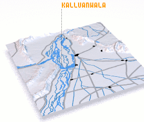 Places with similar names to Kallūānwāla, Pakistan ::
// Klein Wall (DE)
// Kleinweil (DE)
// Klein Welle (DE)
// Glenwillow (US)
// Glen Willow (US)
// Kālānwāli (IN)
// Kelinawala (LK)
// Galanwāla (PK)
// Golīānwāla (PK)
// Goliānwāla (PK)
Disclaimer :: Information on this page comes without warranty of any kind |
||
|
Where is Kallūānwāla? Elevation and coordinates ::
Latitude (lat): 32°33'50"N Longitude (lon): 71°23'25"E
Elevation (approx.): 196m (map arrows pan, magnifying glasses zoom) |
||
|
Visiting Kallūānwāla? Hotel/Accommodation ::
Book a hotel in Kallūānwāla Travel Guide ::
Buy a travel guide for Pakistan rental cars ::
car rental offers GPS waypoint ::
download a GPX waypoint (PoI) of Kallūānwāla for your GPS receiver
|
||