|
search place name
|
||
Kālu Khān (North-West Frontier, Pakistan)Kālu Khān is a town in the North-West Frontier region of Pakistan. An overview map of the region around Kālu Khān is displayed below.
regional and 3d topo map of Kālu Khān, Pakistan ::

Kālu Khān airports ::
The nearest airport is PEW - Peshawar Intl, located 51.1 km south west of Kālu Khān.
Other airports nearby include SDT - Saidu Sharif (68.1 km north east), JAA - Jalalabad (125.9 km west), ISB - Islamabad Chaklala (140.0 km south east), MFG - Muzaffarabad (151.1 km east), Nearby towns ::
Ahsan Khān (0.8km north west) //
Zaidi Gul (1.5km north) //
Amān Shāh (2.0km north) //
Pīr Saddo (1.9km south west) //
Painda Shāh (2.2km north) //
Sharīf Korūna (2.2km north west) //
Didār Korūna (2.6km west) //
Qutbgarh (3.1km north east) //
Bahaderabad (3.3km south) //
Lāli Korūna (3.2km north west) //
Fazal Shāh (3.4km north west) //
Naurazābad (3.2km north east) //
Hajī Khawāla (3.7km north) //
Bāzo Dheri (3.2km north west) //
Khan Muhammad (3.8km north) //
Dherai (3.8km south) //
Nāji Ajoor (3.5km north east) //
Akbar Khān (3.9km south) //
Saiyid Hanīf (3.9km south west) //
Shemaoon (3.7km north east) //
Andāz Khān (3.9km north west) //
Jalāla (3.7km south east) //
Haji Jān Muhammad Dheri (4.3km north) //
Badraga (4.4km north) //
Jumma Khān (4.0km north west) //
Pīr Korūna (4.0km north west) //
Zargan Bānda (4.1km north east) //
Sarāi (4.1km south west) //
Maman (4.2km north west) //
[all distances 'as the bird flies' and approximate] 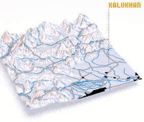 Places with similar names to Kālu Khān, Pakistan ::
// Kalaguhan (PH)
// Kalakahan (PH)
// Küllükhan (TR)
// Galukhino (RU)
// Golukhino (RU)
// Golykhino (RU)
// Galah Khāneh (IR)
// Galeh Khāneh (IR)
// Galeh Khūn (IR)
// Gol Khāneh (IR)
Disclaimer :: Information on this page comes without warranty of any kind |
||
|
Where is Kālu Khān? Elevation and coordinates ::
Latitude (lat): 34°20'59"N Longitude (lon): 71°51'59"E
Elevation (approx.): 377m (map arrows pan, magnifying glasses zoom) |
||
|
Visiting Kālu Khān? Hotel/Accommodation ::
Book a hotel in Kālu Khān Travel Guide ::
Buy a travel guide for Pakistan rental cars ::
car rental offers GPS waypoint ::
download a GPX waypoint (PoI) of Kālu Khān for your GPS receiver
|
||