|
search place name
|
||
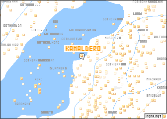
Kamāl Dero (Sind, Pakistan)Kamāl Dero is a town in the Sind region of Pakistan. An overview map of the region around Kamāl Dero is displayed below.
regional and 3d topo map of Kamāl Dero, Pakistan ::
Kamāl Dero airports ::
The nearest airport is MJD - Moenjodaro, located 24.2 km north of Kamāl Dero.
Other airports nearby include SKZ - Sukkur (93.1 km north east), WNS - Nawabshah (102.5 km south), SUL - Sui (197.8 km north east), Nearby towns ::
Goth Dur Muhammad Bhatti (1.1km north east) //
Goth Tātār (1.4km south west) //
Gash Imām Ali Mehesar (1.4km east) //
Goth Abdur Rehmān Machio (2.3km south west) //
Goth Gopāng (2.5km north west) //
Goth Fateh Khān Māri (2.8km east) //
Goth Āhim (3.0km north east) //
Goth Chani Kalhoro (3.3km south east) //
Goth Karam Jamāli (3.6km south) //
Mehar Machio (3.6km south) //
Goth Saida Bāgh (3.5km east) //
Goth Mitho Kalhoro (3.7km north east) //
Goth Kaman Kalhoro (4.0km south) //
Goth Imām Bakhsh Panwāri (3.8km south east) //
Goth Junejo (4.2km north west) //
Goth Mehār Shāh (4.0km north east) //
Goth Misri Punjābi (4.3km south) //
Nauabad (4.4km south) //
Lādho Bishārat (4.3km south west) //
Goth Mad (4.4km north east) //
Goth Pīr Yusaf Shāh (4.4km north east) //
Goth Fāzil Panio (4.3km south east) //
Goth Dhani Bakhsh Kaleri (4.6km south east) //
Goth Bindi Ghulām Shāh (4.6km north east) //
Bakhri (4.6km north east) //
Morio (4.4km east) //
Goth Papri (4.9km south) //
Goth Mian Khān (4.9km south) //
Goth Kalhoro (4.8km south east) //
[all distances 'as the bird flies' and approximate] 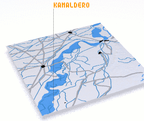 Places with similar names to Kamāl Dero, Pakistan ::
// Çamlıdere (TR)
// Çamlıdere (TR)
// Çamlıdere (TR)
// Çamlıdere (TR)
// Kāmal Diar (BD)
// Kumli Dāra (IN)
// Kammaltera (LK)
// Kamāldero (PK)
// Kŭmuldari (KR)
// Kumāltār (NP)
Disclaimer :: Information on this page comes without warranty of any kind |
||
|
Where is Kamāl Dero? Elevation and coordinates ::
Latitude (lat): 27°7'0"N Longitude (lon): 68°8'20"E
Elevation (approx.): 47m (map arrows pan, magnifying glasses zoom) |
||
|
Visiting Kamāl Dero? Hotel/Accommodation ::
Book a hotel in Kamāl Dero Travel Guide ::
Buy a travel guide for Pakistan rental cars ::
car rental offers GPS waypoint ::
download a GPX waypoint (PoI) of Kamāl Dero for your GPS receiver
|
||