|
search place name
|
||
Kandi Wāri (Sind, Pakistan)Kandi Wāri is a town in the Sind region of Pakistan. An overview map of the region around Kandi Wāri is displayed below.
regional and 3d topo map of Kandi Wāri, Pakistan ::

Kandi Wāri airports ::
The nearest airport is WNS - Nawabshah, located 60.1 km east of Kandi Wāri.
Other airports nearby include MJD - Moenjodaro (110.3 km north), KHI - Karachi Jinnah Intl (176.4 km south), SKZ - Sukkur (177.1 km north east), BDN - Talhar (199.3 km south east), Nearby towns ::
Their (1.7km south east) //
Goth Panju Memon (2.8km north east) //
Sundar (3.0km south west) //
Goth Joha Qāsimjo (3.3km west) //
Goth Akri Ghulām Rasūl (4.1km south west) //
Bāgh Yūsuf (4.5km north) //
Lāl Bāgh (5.0km east) //
Kachhi (5.2km south west) //
Nonar (5.5km north) //
Puntra (5.6km north) //
Shāhbāz Brochan (6.0km north west) //
Bājāra (6.2km south west) //
Khambroth (6.5km north west) //
Bāgh Channa (6.9km north) //
Kando Channa (7.2km north) //
Lāl Ahsān Channa (7.4km north) //
Sehwān (7.5km north east) //
Lāl Shāhbāz Qalandar (7.4km north east) //
Nawāb Rind (9.8km south west) //
Goth Nawāb Khān (10.0km south west) //
[all distances 'as the bird flies' and approximate] 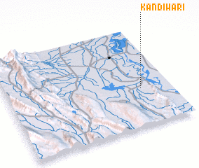 Places with similar names to Kandi Wāri, Pakistan ::
// Kandewāra (PK)
Disclaimer :: Information on this page comes without warranty of any kind |
||
|
Where is Kandi Wāri? Elevation and coordinates ::
Latitude (lat): 26°23'0"N Longitude (lon): 67°49'0"E
Elevation (approx.): 32m (map arrows pan, magnifying glasses zoom) |
||
|
Visiting Kandi Wāri? Hotel/Accommodation ::
Book a hotel in Kandi Wāri Travel Guide ::
Buy a travel guide for Pakistan rental cars ::
car rental offers GPS waypoint ::
download a GPX waypoint (PoI) of Kandi Wāri for your GPS receiver
|
||