|
search place name
|
||
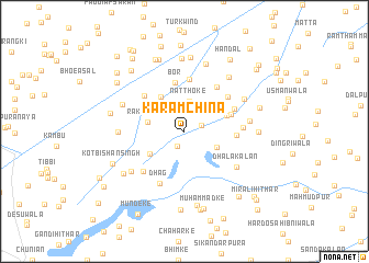
Karam Chīna (Punjab, Pakistan)Karam Chīna is a town in the Punjab region of Pakistan. An overview map of the region around Karam Chīna is displayed below.
regional and 3d topo map of Karam Chīna, Pakistan ::
Karam Chīna airports ::
The nearest airport is LHE - Lahore Allama Iqbal Intl, located 55.4 km north east of Karam Chīna.
Other airports nearby include ATQ - Amritsar (94.5 km north east), LYP - Faisalabad Intl (111.8 km west), LUH - Ludhiaha Ludhiana (176.7 km east), IXJ - Jammu (190.4 km north), Nearby towns ::
Hullarke Uttār (1.6km south) //
Ratti Pindi (1.6km north east) //
Natthoke (3.1km north) //
Shāh Ināyat (3.2km south east) //
Chanda Singh Mazhbiwāla (3.5km north east) //
Sundar Singhwāla (3.4km north east) //
Rakh Dobli (3.3km west) //
Kot Panchānwāla (3.8km south west) //
Kot Nāsir Khān (4.1km north west) //
Chhucha Bukhna (4.0km north east) //
Tara Singhwāla (4.2km north east) //
Miān Singhwāla (4.4km north east) //
Bor (5.1km north) //
Khem Singhwāla (4.5km east) //
Jhuggiān Gurūke (5.3km north) //
Gajjal Bangāla (5.1km north west) //
Mughlān-di-Haveli (5.3km north east) //
Sardā-Chet Singhwāla (4.9km north east) //
Dhāla Khurd (5.2km north east) //
Barki (5.4km south west) //
Dhag (5.7km south) //
Jawāhir Singhwāla (5.1km east) //
Dhāla Kalān (5.9km south east) //
Sunder Singhwāli (5.8km east) //
Rakh Mundeke Kalān (5.8km west) //
Kot Dhāra Singh (6.2km south west) //
Gandi Uttār (6.1km north west) //
Bhāgwānpura (6.2km north east) //
Rāwal Jahangar (6.8km north east) //
[all distances 'as the bird flies' and approximate] 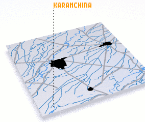 Places with similar names to Karam Chīna, Pakistan ::
// Kermeshna (RU)
// Kormchino (RU)
// Karamechen (BW)
// Garmīshān (IR)
// Karam Shan (IR)
// Karīm Īshān (IR)
// Karīm Īshān (IR)
// Gromshin (BG)
Disclaimer :: Information on this page comes without warranty of any kind |
||
|
Where is Karam Chīna? Elevation and coordinates ::
Latitude (lat): 31°5'4"N Longitude (lon): 74°7'20"E
Elevation (approx.): 200m (map arrows pan, magnifying glasses zoom) |
||
|
Visiting Karam Chīna? Hotel/Accommodation ::
Book a hotel in Karam Chīna Travel Guide ::
Buy a travel guide for Pakistan rental cars ::
car rental offers GPS waypoint ::
download a GPX waypoint (PoI) of Karam Chīna for your GPS receiver
|
||