|
search place name
|
||
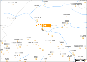
Kārezgai (Balochistān, Pakistan)Kārezgai is a town in the Balochistān region of Pakistan. An overview map of the region around Kārezgai is displayed below.
regional and 3d topo map of Kārezgai, Pakistan ::
Kārezgai airports ::
The nearest airport is UET - Quetta, located 99.5 km south west of Kārezgai.
Other airports nearby include KDH - Kandahar (160.5 km west), Nearby towns ::
Behrām Khān (0.7km north east) //
Changai (0.9km east) //
Manzake (2.2km north) //
Shamīr (2.2km south east) //
Murgha (2.8km north east) //
Habīb Kili (3.8km south east) //
Nigānd (4.2km east) //
Walang Haqdao Kili (4.9km north west) //
Tsatsobai (5.3km south west) //
Sūr Kach (5.5km north west) //
Bāhar Chīna (5.5km south east) //
Khelāla (6.4km south west) //
Sargarhgi (6.6km south) //
Zhertangai (7.1km south west) //
Yūsuf (6.8km south west) //
Tangai (7.7km south) //
Ziārat (7.1km east) //
Sagai (8.3km south) //
Bachak (8.6km south east) //
Shpāna Tlerai (8.9km south west) //
Surai (8.8km south east) //
Wulgai (9.3km south east) //
Wulgai (10.6km south east) //
[all distances 'as the bird flies' and approximate] 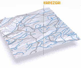 Places with similar names to Kārezgai, Pakistan ::
Disclaimer :: Information on this page comes without warranty of any kind |
||
|
Where is Kārezgai? Elevation and coordinates ::
Latitude (lat): 31°2'10"N Longitude (lon): 67°26'30"E
Elevation (approx.): 2302m (map arrows pan, magnifying glasses zoom) |
||
|
Visiting Kārezgai? Hotel/Accommodation ::
Book a hotel in Kārezgai Travel Guide ::
Buy a travel guide for Pakistan rental cars ::
car rental offers GPS waypoint ::
download a GPX waypoint (PoI) of Kārezgai for your GPS receiver
|
||