|
search place name
|
||
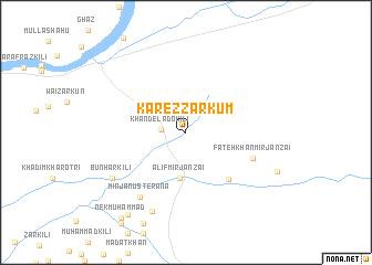
Karez Zarkūm (Balochistān, Pakistan)Karez Zarkūm is a town in the Balochistān region of Pakistan. An overview map of the region around Karez Zarkūm is displayed below.
regional and 3d topo map of Karez Zarkūm, Pakistan ::
Karez Zarkūm airports ::
The nearest airport is PZH - Zhob, located 137.0 km north of Karez Zarkūm.
Other airports nearby include SUL - Sui (167.8 km south), RYK - Rahim Yar Khan Sheikh Zayed (226.6 km south east), Nearby towns ::
Khande Lādo Kili (2.2km west) //
Alif Mīrjānzai (4.7km south) //
Bakhtiār Khān Katta Khel (6.1km south east) //
Fateh Khān Mīrjānzai (6.4km south east) //
Mīrjān Usterāna (7.6km south west) //
Dariāzai (8.6km south) //
Bunhar Kili (7.9km south west) //
Bagat Katta Khel (9.8km south west) //
Nek Muhammad (10.3km south west) //
[all distances 'as the bird flies' and approximate]  Places with similar names to Karez Zarkūm, Pakistan ::
// Keur Saer Gom (SN)
Disclaimer :: Information on this page comes without warranty of any kind |
||
|
Where is Karez Zarkūm? Elevation and coordinates ::
Latitude (lat): 30°9'30"N Longitude (lon): 69°7'20"E
Elevation (approx.): 965m (map arrows pan, magnifying glasses zoom) |
||
|
Visiting Karez Zarkūm? Hotel/Accommodation ::
Book a hotel in Karez Zarkūm Travel Guide ::
Buy a travel guide for Pakistan rental cars ::
car rental offers GPS waypoint ::
download a GPX waypoint (PoI) of Karez Zarkūm for your GPS receiver
|
||