|
search place name
|
||
Karīm Kot (Federally Administered Tribal Areas, Pakistan)Karīm Kot is a town in the Federally Administered Tribal Areas region of Pakistan. An overview map of the region around Karīm Kot is displayed below.
regional and 3d topo map of Karīm Kot, Pakistan ::

Karīm Kot airports ::
The nearest airport is PZH - Zhob, located 114.9 km south of Karīm Kot.
Nearby towns ::
Wuchoba (1.2km south east) //
Aghzaikas (1.5km north) //
Amīn Shāh (2.3km north) //
Sāghari (2.4km north east) //
Said Muhammad (2.8km north) //
Janai (2.9km north) //
Zarmahīn (3.2km north) //
Sholam (3.6km south) //
Ajīm Khān (3.8km north) //
Shindal (4.3km north) //
Sardār (4.3km north) //
Khojal Khel (4.7km north) //
Pishai (4.7km north) //
Karīmai Manraī (4.9km south) //
Toji Khel (5.4km south) //
Rakhīm (5.7km north) //
Bay Gul (5.8km north) //
Zer Zāwar (5.9km south west) //
Ziābai (6.2km north east) //
Zer Zāwar (6.5km south west) //
Mandorai (7.7km north east) //
Jānīmela (7.8km north east) //
Chīnai (8.2km north west) //
Inzar Ghwashkai (8.9km south west) //
Sraghara (11.3km south west) //
[all distances 'as the bird flies' and approximate] 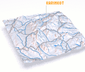 Places with similar names to Karīm Kot, Pakistan ::
// Kuoramykyt (RU)
// Guramguda (IN)
// Karambakkudi (IN)
// Karimkot (PK)
// Karmkot (PK)
// Caramacate (VE)
// Caramacate (VE)
// Caramacate (VE)
// Caramacate (VE)
// Caramacate (VE)
Disclaimer :: Information on this page comes without warranty of any kind |
||
|
Where is Karīm Kot? Elevation and coordinates ::
Latitude (lat): 32°23'40"N Longitude (lon): 69°28'30"E
Elevation (approx.): 1738m (map arrows pan, magnifying glasses zoom) |
||
|
Visiting Karīm Kot? Hotel/Accommodation ::
Book a hotel in Karīm Kot Travel Guide ::
Buy a travel guide for Pakistan rental cars ::
car rental offers GPS waypoint ::
download a GPX waypoint (PoI) of Karīm Kot for your GPS receiver
|
||