|
search place name
|
||
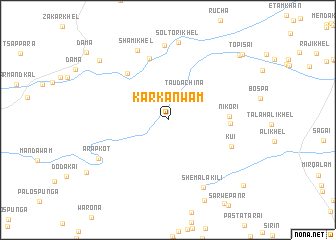
Karkanwām (Federally Administered Tribal Areas, Pakistan)Karkanwām is a town in the Federally Administered Tribal Areas region of Pakistan. An overview map of the region around Karkanwām is displayed below.
regional and 3d topo map of Karkanwām, Pakistan ::
Karkanwām airports ::
The nearest airport is PEW - Peshawar Intl, located 175.7 km north east of Karkanwām.
Other airports nearby include PZH - Zhob (175.9 km south west), JAA - Jalalabad (181.9 km north), KBL - Kabul Intl (224.6 km north west), Nearby towns ::
Tauda Chīna (3.5km north east) //
Nikori (5.8km east) //
Kamar Kolle (6.4km north west) //
Sher Khāni (5.9km east) //
Altamirkot (7.1km north) //
Kūi (6.7km south east) //
Sein (8.4km north) //
Shami Khel (8.3km north) //
Shemala Kili (8.3km south east) //
Sol Tori Khel (8.7km north) //
Arap Kot (7.8km south west) //
Ali Khel (9.3km north west) //
Chagal (9.9km north east) //
Topisai (10.1km north east) //
Chel Khāna (10.2km south east) //
[all distances 'as the bird flies' and approximate] 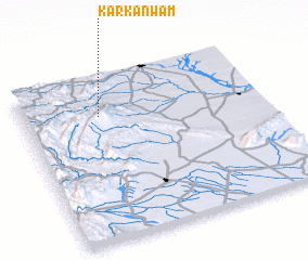 Places with similar names to Karkanwām, Pakistan ::
// Karkan Wām (PK)
Disclaimer :: Information on this page comes without warranty of any kind |
||
|
Where is Karkanwām? Elevation and coordinates ::
Latitude (lat): 32°45'58"N Longitude (lon): 70°19'19"E
Elevation (approx.): 737m (map arrows pan, magnifying glasses zoom) |
||
|
Visiting Karkanwām? Hotel/Accommodation ::
Book a hotel in Karkanwām Travel Guide ::
Buy a travel guide for Pakistan rental cars ::
car rental offers GPS waypoint ::
download a GPX waypoint (PoI) of Karkanwām for your GPS receiver
|
||