|
search place name
|
||
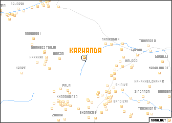
Karwanda (Federally Administered Tribal Areas, Pakistan)Karwanda is a town in the Federally Administered Tribal Areas region of Pakistan. An overview map of the region around Karwanda is displayed below.
regional and 3d topo map of Karwanda, Pakistan ::
Karwanda airports ::
The nearest airport is PZH - Zhob, located 163.3 km south of Karwanda.
Other airports nearby include JAA - Jalalabad (188.4 km north), KBL - Kabul Intl (203.7 km north), PEW - Peshawar Intl (206.1 km north east), Nearby towns ::
Om (3.2km north east) //
Sharkai Kili (4.0km north east) //
Barzai (4.8km west) //
Zangai Kili (5.3km north east) //
Muhammad Jān Kili (5.6km south east) //
Raghzi Kili (5.6km east) //
Māmi Rogha (6.0km north east) //
Zor Kot (5.7km east) //
Gozhe Kili (5.8km south east) //
Azīz Khel (6.6km south east) //
Sadai Kili (6.4km south east) //
Datta Khel Raghzai (7.1km south) //
Razāni (6.2km east) //
Palaī (7.1km south west) //
Sarkai Raghzai (7.4km south) //
Oghuz Zawa (7.6km south west) //
Shakhwadi Raghzai (7.5km south east) //
Zargar Khel (6.8km east) //
Kazhamisht (8.0km south) //
Wuche Faqiran Kili (7.0km east) //
Zghāri Wara (7.9km south) //
Kazha Nashtar (7.6km south west) //
Saleri (6.9km west) //
Maohi Khel (7.7km south east) //
Sulaimāni (6.9km east) //
Ghozak Khel (8.3km south) //
MalaiZhāwar (7.7km south east) //
Ragzai (8.0km south east) //
Dwa Kamar Kas (7.2km west) //
[all distances 'as the bird flies' and approximate]  Places with similar names to Karwanda, Pakistan ::
Disclaimer :: Information on this page comes without warranty of any kind |
||
|
Where is Karwanda? Elevation and coordinates ::
Latitude (lat): 32°48'0"N Longitude (lon): 69°49'0"E
Elevation (approx.): 2207m (map arrows pan, magnifying glasses zoom) |
||
|
Visiting Karwanda? Hotel/Accommodation ::
Book a hotel in Karwanda Travel Guide ::
Buy a travel guide for Pakistan rental cars ::
car rental offers GPS waypoint ::
download a GPX waypoint (PoI) of Karwanda for your GPS receiver
|
||