|
search place name
|
||
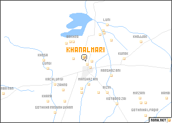
Khānal Māri (Punjab, Pakistan)Khānal Māri is a town in the Punjab region of Pakistan. An overview map of the region around Khānal Māri is displayed below.
regional and 3d topo map of Khānal Māri, Pakistan ::
Khānal Māri airports ::
The nearest airport is UET - Quetta, located 118.5 km north west of Khānal Māri.
Other airports nearby include SUL - Sui (162.4 km south east), SKZ - Sukkur (222.7 km south east), PZH - Zhob (250.9 km north east), Nearby towns ::
Dehpāl Bostān (0.7km south east) //
Maulwi Shahr (1.1km east) //
Sibi (1.5km south east) //
Dehpāl (2.5km west) //
Marghazāni (5.0km south) //
Bakhra (5.0km north west) //
Bakhra (5.2km north west) //
Bakhra (5.5km north west) //
Sūfi Dur Khān (5.9km south) //
Marghazāni (5.7km south east) //
Kamāl Khān Shahr (6.5km north east) //
Bostān (6.8km south) //
Doni Brāhui (6.7km north east) //
Marghazāni (7.2km south) //
Hāji Shāh Muhammad Shahr (7.1km north east) //
Gulu Shāhr (7.5km north east) //
Zāhro (7.5km south west) //
Mizri (7.9km south east) //
Kurak (7.3km east) //
Kach Lundi (7.7km south west) //
Lundi (7.4km west) //
Lūni (9.0km north east) //
Kach Wālhari (9.5km south west) //
Khāra (11.3km south west) //
[all distances 'as the bird flies' and approximate] 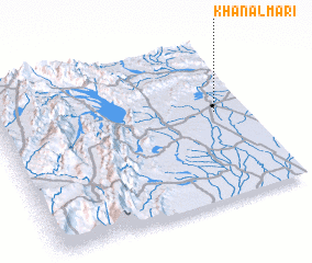 Places with similar names to Khānal Māri, Pakistan ::
// Khān al Aḩmar (SY)
Disclaimer :: Information on this page comes without warranty of any kind |
||
|
Where is Khānal Māri? Elevation and coordinates ::
Latitude (lat): 29°33'40"N Longitude (lon): 67°52'30"E
Elevation (approx.): 138m (map arrows pan, magnifying glasses zoom) |
||
|
Visiting Khānal Māri? Hotel/Accommodation ::
Book a hotel in Khānal Māri Travel Guide ::
Buy a travel guide for Pakistan rental cars ::
car rental offers GPS waypoint ::
download a GPX waypoint (PoI) of Khānal Māri for your GPS receiver
|
||