|
search place name
|
||
Khāngarh (Sind, Pakistan)Khāngarh is a town in the Sind region of Pakistan. An overview map of the region around Khāngarh is displayed below.
regional and 3d topo map of Khāngarh, Pakistan ::

Khāngarh airports ::
The nearest airport is SKZ - Sukkur, located 64.0 km west of Khāngarh.
Other airports nearby include SUL - Sui (89.2 km north), RYK - Rahim Yar Khan Sheikh Zayed (101.9 km north east), MJD - Moenjodaro (139.2 km south west), JSA - Jaisalmer (179.6 km south east), Nearby towns ::
Goth Terar (1.6km north east) //
Goth Gārho Daro (2.2km north) //
Wāhi Dino (1.9km west) //
Āri Mahar (2.1km north east) //
Ganjwāni (2.0km east) //
Goth Momin Mahar (2.3km south) //
Goth Khair Muhammad (2.3km south west) //
Goth Jaskāni (2.2km east) //
Mithal Mahar (2.4km north west) //
Goth Dhani (2.5km north west) //
Goth Sharīf Keti (2.5km west) //
Imām Bakhsh Gabol (3.1km south) //
Pīr Bakhsh Mahar (3.1km north) //
Goth Lāl Ālmāni (2.8km east) //
Malik Mahar (3.2km north west) //
Bhiri Laghāri (3.0km east) //
Goth Khaire Mahar (3.4km south west) //
Goth Hāji Wāhid Bakhsh (3.4km south east) //
Pathān Keti (3.5km south west) //
Goth Ālmāni (3.4km east) //
Goth Khuda Bakhsh Mahar (3.8km north east) //
Malik Wāsu (3.8km north west) //
Bākkar Shahīd (3.6km north east) //
Khānpur (4.0km south) //
Muhammad Bakhsh Keti (3.7km west) //
Mithri (3.9km north west) //
Goth Hāji (4.3km north) //
Rānjha Pītāfi (4.1km north east) //
Muhammad Mahar (4.1km north east) //
[all distances 'as the bird flies' and approximate] 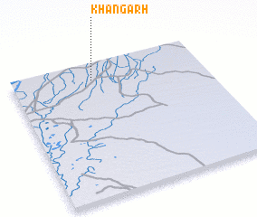 Places with similar names to Khāngarh, Pakistan ::
Disclaimer :: Information on this page comes without warranty of any kind |
||
|
Where is Khāngarh? Elevation and coordinates ::
Latitude (lat): 27°52'10"N Longitude (lon): 69°25'10"E
Elevation (approx.): 69m (map arrows pan, magnifying glasses zoom) |
||
|
Visiting Khāngarh? Hotel/Accommodation ::
Book a hotel in Khāngarh Travel Guide ::
Buy a travel guide for Pakistan rental cars ::
car rental offers GPS waypoint ::
download a GPX waypoint (PoI) of Khāngarh for your GPS receiver
|
||