|
search place name
|
||
Kharigām (Pakistan)Kharigām is a town in Pakistan. An overview map of the region around Kharigām is displayed below.
regional and 3d topo map of Kharigām, Pakistan ::

Kharigām airports ::
The nearest airport is MFG - Muzaffarabad, located 76.8 km south west of Kharigām.
Other airports nearby include SXR - Srinagar (105.3 km south east), RAZ - Rawala Kot Rawalakot (108.5 km south), GIL - Gilgit (127.1 km north), ISB - Islamabad Chaklala (161.6 km south west), Nearby towns ::
Shardi (3.6km north east) //
Barthi (4.4km south east) //
Mundkaro (4.7km south) //
Bantil (5.3km south east) //
Dangar (5.4km south) //
Khushak Seri (5.6km south east) //
Chattuān (6.1km south) //
Bhabbān (6.3km south) //
Tejiān (6.9km south) //
Bhurjāli (6.5km south west) //
Seri (7.1km south east) //
Jabri (7.1km south west) //
Shekh Bela (7.6km south) //
Ghuri (7.5km south) //
Hawai (7.5km south west) //
Muhamad Khān Bela (8.3km south) //
Jabba (7.5km south east) //
Chhanj (8.4km south) //
Aner Bela (8.8km south) //
Chināt (7.9km south west) //
Kalsi (8.8km south) //
Lashdat Baihk (8.6km south east) //
Barawan (9.4km south) //
Chāngdābar (9.6km south west) //
Reshna (11.0km south west) //
[all distances 'as the bird flies' and approximate] 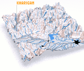
Disclaimer :: Information on this page comes without warranty of any kind |
||
|
Where is Kharigām? Elevation and coordinates ::
Latitude (lat): 34°47'0"N Longitude (lon): 74°9'0"E
Elevation (approx.): 2239m (map arrows pan, magnifying glasses zoom) |
||
|
Visiting Kharigām? Hotel/Accommodation ::
Book a hotel in Kharigām Travel Guide ::
Buy a travel guide for Pakistan rental cars ::
car rental offers GPS waypoint ::
download a GPX waypoint (PoI) of Kharigām for your GPS receiver
|
||