|
search place name
|
||
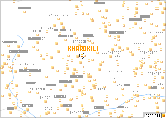
Khāro Kili (Federally Administered Tribal Areas, Pakistan)Khāro Kili is a town in the Federally Administered Tribal Areas region of Pakistan. An overview map of the region around Khāro Kili is displayed below.
regional and 3d topo map of Khāro Kili, Pakistan ::
Khāro Kili airports ::
The nearest airport is SDT - Saidu Sharif, located 72.9 km east of Khāro Kili.
Other airports nearby include PEW - Peshawar Intl (97.9 km south), JAA - Jalalabad (110.7 km south west), MFG - Muzaffarabad (188.5 km east), ISB - Islamabad Chaklala (199.1 km south east), Nearby towns ::
Bigal (0.8km north east) //
Dāmān (1.0km south west) //
Doparai (1.2km north west) //
Narāza (1.2km east) //
Laku (1.8km south) //
Urbali (1.6km north east) //
Derogat (1.8km east) //
Sadokai (2.3km south) //
Atkai (2.0km south west) //
Dand (2.4km south west) //
Kotkai (2.1km west) //
Dagai (2.8km south) //
Gawa (2.7km north west) //
Changar (3.0km south) //
Bilmaskot (2.9km south west) //
Sangu Dheri (3.1km south) //
Jabagai (3.0km north east) //
Tandoka (3.1km north) //
Arkanai (2.8km west) //
Topan Shāh (2.8km west) //
Dresari (3.0km north east) //
Mātor (3.6km south) //
Giro (3.0km east) //
Pashat (3.2km south west) //
Dolasmanai (3.8km south west) //
Gambat (3.4km west) //
Chinargo (3.6km south west) //
Kandaro (4.1km south) //
Kafirgat (3.5km east) //
[all distances 'as the bird flies' and approximate] 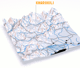 Places with similar names to Khāro Kili, Pakistan ::
// Kharagol (RU)
// Kharikolo (RU)
// Kharkāla (IN)
// Kharkāli (IN)
// Gowhar Kolā (IR)
// Khargalū (IR)
// Khergalū (IR)
// Kheyr Qolī (IR)
// Khīār Kāl (IR)
// Khīār Kāleh (IR)
Disclaimer :: Information on this page comes without warranty of any kind |
||
|
Where is Khāro Kili? Elevation and coordinates ::
Latitude (lat): 34°52'33"N Longitude (lon): 71°33'33"E
Elevation (approx.): 930m (map arrows pan, magnifying glasses zoom) |
||
|
Visiting Khāro Kili? Hotel/Accommodation ::
Book a hotel in Khāro Kili Travel Guide ::
Buy a travel guide for Pakistan rental cars ::
car rental offers GPS waypoint ::
download a GPX waypoint (PoI) of Khāro Kili for your GPS receiver
|
||