|
search place name
|
||
Khattak Bānda (North-West Frontier, Pakistan)Khattak Bānda is a town in the North-West Frontier region of Pakistan. An overview map of the region around Khattak Bānda is displayed below.
regional and 3d topo map of Khattak Bānda, Pakistan ::

Khattak Bānda airports ::
The nearest airport is PEW - Peshawar Intl, located 86.4 km north east of Khattak Bānda.
Other airports nearby include JAA - Jalalabad (119.8 km north), SDT - Saidu Sharif (205.5 km north east), KBL - Kabul Intl (206.4 km north west), Nearby towns ::
Shinalaj (2.5km west) //
Katgarh Bānda (4.2km east) //
Tari Bānda (4.8km west) //
Muhammad Khwāja (6.7km north) //
Landukai (7.1km south) //
Kundi (7.3km south) //
Mardān Khel (7.4km south east) //
Togh (7.9km north east) //
Mattu Khel (7.8km south west) //
Shaish Amīr Kili (8.7km south) //
Urmar (8.2km south east) //
Chal (8.5km south east) //
Trikhsam (8.9km south west) //
Sūfi Landan (9.4km south) //
Barabbas Khel (9.7km north east) //
Dashai (9.3km south west) //
Khezu Bānda (10.0km north west) //
[all distances 'as the bird flies' and approximate] 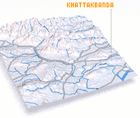 Places with similar names to Khattak Bānda, Pakistan :: Disclaimer :: Information on this page comes without warranty of any kind |
||
|
Where is Khattak Bānda? Elevation and coordinates ::
Latitude (lat): 33°23'0"N Longitude (lon): 70°56'11"E
Elevation (approx.): 899m (map arrows pan, magnifying glasses zoom) |
||
|
Visiting Khattak Bānda? Hotel/Accommodation ::
Book a hotel in Khattak Bānda Travel Guide ::
Buy a travel guide for Pakistan rental cars ::
car rental offers GPS waypoint ::
download a GPX waypoint (PoI) of Khattak Bānda for your GPS receiver
|
||