|
search place name
|
||
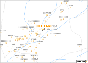
Kili Tegak (Balochistān, Pakistan)Kili Tegak is a town in the Balochistān region of Pakistan. An overview map of the region around Kili Tegak is displayed below.
regional and 3d topo map of Kili Tegak, Pakistan ::
Kili Tegak airports ::
The nearest airport is UET - Quetta, located 220.6 km north of Kili Tegak.
Other airports nearby include MJD - Moenjodaro (225.0 km south east), Nearby towns ::
Tegak (1.6km north west) //
Māndānwāla (2.1km south east) //
Kili Alizai (2.0km north east) //
Kili Hadi Islām (2.2km north) //
Kili Zehri (2.4km west) //
Shar (2.7km south west) //
Hadi Islām (2.8km south west) //
Khāliq Ābād (3.0km east) //
Nichāri (3.4km south) //
Madad Khān (3.1km south west) //
Hussainzai (3.1km west) //
Rahim Bakhsh (4.4km north) //
Chilbāghu (4.6km north) //
Nokjo (4.4km east) //
Mir Muhammad (4.7km east) //
Dīnār (4.7km west) //
Mazār (4.7km west) //
Kili Chilbāghu (5.0km north west) //
Mullāzai (5.4km south) //
Senāri (5.6km south west) //
Ehsānābād (6.2km north) //
Shorai Bārān (5.6km west) //
Lushkri (6.3km south west) //
Kili Mūllazai (6.0km north west) //
Handi Zehri (6.3km south west) //
Kili Anwar (7.1km north) //
Kili Dīnārzai (6.3km west) //
Chad Mal (7.4km south west) //
Sāsoli Zehri (7.0km south west) //
[all distances 'as the bird flies' and approximate] 
Disclaimer :: Information on this page comes without warranty of any kind |
||
|
Where is Kili Tegak? Elevation and coordinates ::
Latitude (lat): 28°22'30"N Longitude (lon): 66°10'50"E
Elevation (approx.): 1671m (map arrows pan, magnifying glasses zoom) |
||
|
Visiting Kili Tegak? Hotel/Accommodation ::
Book a hotel in Kili Tegak Travel Guide ::
Buy a travel guide for Pakistan rental cars ::
car rental offers GPS waypoint ::
download a GPX waypoint (PoI) of Kili Tegak for your GPS receiver
|
||