|
search place name
|
||
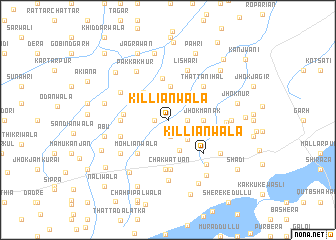
Killiānwāla (Punjab, Pakistan)Killiānwāla is a town in the Punjab region of Pakistan. An overview map of the region around Killiānwāla is displayed below.
regional and 3d topo map of Killiānwāla, Pakistan ::
Killiānwāla airports ::
The nearest airport is LYP - Faisalabad Intl, located 56.0 km north of Killiānwāla.
Other airports nearby include MUX - Multan Intl (159.8 km south west), LHE - Lahore Allama Iqbal Intl (160.9 km north east), ATQ - Amritsar (203.6 km north east), IXJ - Jammu (273.1 km north east), Nearby towns ::
Gugere (1.3km west) //
Mīran Shāh (1.9km south) //
Mansūr Ke Malang (1.9km east) //
Bundāniān (2.8km south east) //
Chak Five Hundred Ninety-seven (3.6km south) //
Arain Majra (3.7km north) //
Dānābād Kalān (3.7km north) //
Jhok Mānak (3.4km east) //
Machha Nikka (3.9km north west) //
Chak Four Hundred Eighty-six (4.7km north) //
Chak Four Hundred Ninety-five (4.3km west) //
Mohliānwāla (4.7km south west) //
Nawāb Bhūti (4.5km west) //
Thatta Nihāl (5.1km north east) //
Killiānwāla (5.1km south east) //
Vahniwāl (4.9km west) //
Chak Watuan (5.6km south) //
Chak Five Hundred Forty-eight (5.6km south) //
Lishāri (5.9km north) //
Chak Four Hundred Eighty-eight (5.5km north west) //
Billarwāld (5.4km east) //
Ghāzi Kāthia (5.8km south west) //
Pakka Khur (6.2km north west) //
Chāh Malangu (5.6km east) //
Thatta Purbāna (6.2km south east) //
Chak Five Hundred Forty-eight (6.8km south) //
Chāh Ādumwāla (6.3km south east) //
Chāh Manjka (6.1km east) //
Chak Five Hundred Fifty-five (6.9km south west) //
[all distances 'as the bird flies' and approximate]  Places with similar names to Killiānwāla, Pakistan ::
// Klein Wall (DE)
// Kleinweil (DE)
// Klein Welle (DE)
// Glenwillow (US)
// Glen Willow (US)
// Kālānwāli (IN)
// Kelinawala (LK)
// Galanwāla (PK)
// Golīānwāla (PK)
// Goliānwāla (PK)
Disclaimer :: Information on this page comes without warranty of any kind |
||
|
Where is Killiānwāla? Elevation and coordinates ::
Latitude (lat): 30°52'0"N Longitude (lon): 72°53'50"E
Elevation (approx.): 170m (map arrows pan, magnifying glasses zoom) |
||
|
Visiting Killiānwāla? Hotel/Accommodation ::
Book a hotel in Killiānwāla Travel Guide ::
Buy a travel guide for Pakistan rental cars ::
car rental offers GPS waypoint ::
download a GPX waypoint (PoI) of Killiānwāla for your GPS receiver
|
||