|
search place name
|
||
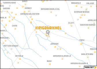
Kiri Godai Khel (North-West Frontier, Pakistan)Kiri Godai Khel is a town in the North-West Frontier region of Pakistan. An overview map of the region around Kiri Godai Khel is displayed below.
regional and 3d topo map of Kiri Godai Khel, Pakistan ::
Kiri Godai Khel airports ::
The nearest airport is PZH - Zhob, located 143.1 km south west of Kiri Godai Khel.
Other airports nearby include PEW - Peshawar Intl (220.8 km north), MUX - Multan Intl (225.6 km south), Nearby towns ::
Kiri Mūsa Khān (0.2km south) //
Kiri Allāhdād Khel (0.4km south) //
Malang (0.7km south) //
Kiri Rashīd Khel (0.8km south west) //
Sigi (0.8km west) //
Kiri Mira Khel (1.0km west) //
Daulatpur Qalanaar (2.5km north) //
Kiri Bahādur Khel (3.4km north west) //
Takwāra (4.1km west) //
Jandrān (5.2km south east) //
Kiri Laki (4.9km north west) //
Shāhzāda (5.5km east) //
Nāmdāri (6.3km south east) //
Sadra Sharīf (6.8km south east) //
Bānda Jandar (7.8km north) //
Bakhu (7.3km north west) //
Gurlangi (7.5km north west) //
Khola (8.1km north west) //
Bānda Bahāwal Kehl (8.8km north) //
Giloti (8.2km north east) //
Giloti (8.2km north east) //
Garah Audal Purāna (9.1km north west) //
[all distances 'as the bird flies' and approximate] 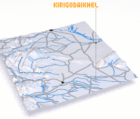 Places with similar names to Kiri Godai Khel, Pakistan :: Disclaimer :: Information on this page comes without warranty of any kind |
||
|
Where is Kiri Godai Khel? Elevation and coordinates ::
Latitude (lat): 32°8'1"N Longitude (lon): 70°40'16"E
Elevation (approx.): 215m (map arrows pan, magnifying glasses zoom) |
||
|
Visiting Kiri Godai Khel? Hotel/Accommodation ::
Book a hotel in Kiri Godai Khel Travel Guide ::
Buy a travel guide for Pakistan rental cars ::
car rental offers GPS waypoint ::
download a GPX waypoint (PoI) of Kiri Godai Khel for your GPS receiver
|
||