|
search place name
|
||
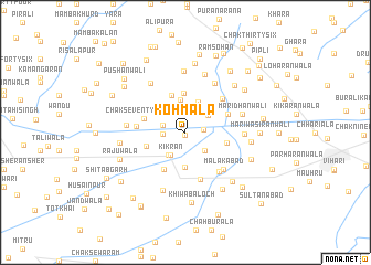
Koh Māla (Punjab, Pakistan)Koh Māla is a town in the Punjab region of Pakistan. An overview map of the region around Koh Māla is displayed below.
regional and 3d topo map of Koh Māla, Pakistan ::
Koh Māla airports ::
The nearest airport is MUX - Multan Intl, located 78.2 km west of Koh Māla.
Other airports nearby include LYP - Faisalabad Intl (162.2 km north east), RYK - Rahim Yar Khan Sheikh Zayed (265.0 km south west), Nearby towns ::
Khichchiānwāli Bheni (0.3km south) //
Chak Seventy-two-Seven R WB (1.6km east) //
Chak Seventy-six-Seven R WB (2.0km west) //
Chak Seventy-four WB (2.1km west) //
Sattārābād (2.5km south east) //
Kikran (2.7km south west) //
Chak Forty-two WB (2.6km north east) //
Chak One Hundred Seventy-two-Seven R WB (2.7km south west) //
Rāiānwāli Bheni (3.3km north) //
Garhwāl (3.1km north east) //
Bhattiāwāli (3.3km north) //
Chak One Hundred Fifty-five-Ten L (3.6km south) //
Chak Forty-six WB (3.9km north) //
Murādwāli Bheni (4.0km north) //
Chak Eighty-Seven R WB (3.7km west) //
Chak One Hundred Fifty-seven-Ten L WB (4.2km south west) //
Chak Eighty-three-Nine L (3.8km east) //
Chak Seventy-eight WB (3.9km west) //
Charholānwāla (4.2km north east) //
Chak Seventy-eight WB (4.3km west) //
Dingo Sunehrewāla (4.7km north east) //
Kandūrwāla (5.0km south) //
Chah Chikrāla (5.0km south east) //
Malakābād (5.0km south east) //
Pushānwāli (5.6km north east) //
Māri Dhānwāli (5.3km east) //
Bhattiānwāla (5.2km east) //
Dāchiwāla (5.3km west) //
Chak Fifty-two WB (5.8km north west) //
[all distances 'as the bird flies' and approximate] 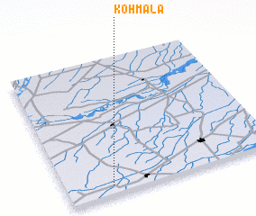 Places with similar names to Koh Māla, Pakistan ::
Disclaimer :: Information on this page comes without warranty of any kind |
||
|
Where is Koh Māla? Elevation and coordinates ::
Latitude (lat): 30°4'0"N Longitude (lon): 72°12'55"E
Elevation (approx.): 139m (map arrows pan, magnifying glasses zoom) |
||
|
Visiting Koh Māla? Hotel/Accommodation ::
Book a hotel in Koh Māla Travel Guide ::
Buy a travel guide for Pakistan rental cars ::
car rental offers GPS waypoint ::
download a GPX waypoint (PoI) of Koh Māla for your GPS receiver
|
||