|
search place name
|
||
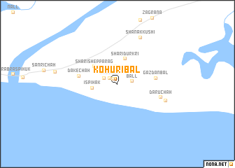
Kohuribal (Balochistān, Pakistan)Kohuribal is a town in the Balochistān region of Pakistan. An overview map of the region around Kohuribal is displayed below.
regional and 3d topo map of Kohuribal, Pakistan ::
Kohuribal airports ::
The nearest airport is PSI - Pasni, located 54.2 km west of Kohuribal.
Other airports nearby include TRB - Turbo Turbat Intl (108.3 km north west), GWD - Gwadar (156.5 km west), PJG - Panjgur (176.6 km north), Nearby towns ::
Kahori (1.0km north west) //
Kaz Chāh (1.5km north west) //
Ball (2.1km east) //
Kandi (2.2km north west) //
Hamrag (2.8km north) //
Ispihak (3.7km west) //
Shāri Durkri (4.2km north) //
Shāri Shep Parag (4.4km north west) //
Gazdānbal (5.7km east) //
Dake Chāh (5.7km west) //
Dāru Chāh (6.6km east) //
Nālāni Tehab (7.5km east) //
Shanak Kushi (8.1km north east) //
[all distances 'as the bird flies' and approximate] 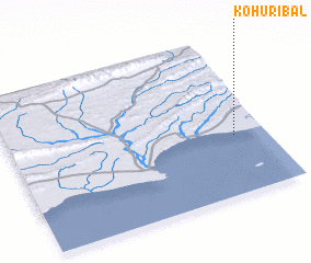 Places with similar names to Kohuribal, Pakistan ::
// Kharabali (RU)
// Kharbala (RU)
// Kharbala (RU)
// Khar-Bala (TM)
// Kharbal (IR)
// Khowr-e Bālā (IR)
// Khūrāblū (IR)
// Kharāb Bāl (SY)
// Kharbali (GE)
// Khorbalo (GE)
Disclaimer :: Information on this page comes without warranty of any kind |
||
|
Where is Kohuribal? Elevation and coordinates ::
Latitude (lat): 25°22'40"N Longitude (lon): 63°52'30"E
Elevation (approx.): 3m (map arrows pan, magnifying glasses zoom) |
||
|
Visiting Kohuribal? Hotel/Accommodation ::
Book a hotel in Kohuribal Travel Guide ::
Buy a travel guide for Pakistan rental cars ::
car rental offers GPS waypoint ::
download a GPX waypoint (PoI) of Kohuribal for your GPS receiver
|
||