|
search place name
|
||
Kot Dāin (North-West Frontier, Pakistan)Kot Dāin is a town in the North-West Frontier region of Pakistan. An overview map of the region around Kot Dāin is displayed below.
regional and 3d topo map of Kot Dāin, Pakistan ::

Kot Dāin airports ::
The nearest airport is PEW - Peshawar Intl, located 138.4 km north east of Kot Dāin.
Other airports nearby include JAA - Jalalabad (155.6 km north), PZH - Zhob (211.9 km south west), KBL - Kabul Intl (216.8 km north west), SDT - Saidu Sharif (257.5 km north east), Nearby towns ::
Kot Barra (0.4km north west) //
Fātima Khel (1.2km south) //
Fort Edwardes (1.1km south west) //
Mirza Beg (1.4km north) //
Bannu Cantonment (1.2km west) //
Parez Khoni Khel (1.5km north east) //
Bannu (1.6km south west) //
Rehmai Kili (1.5km north east) //
Kotkai Ghaus Amīr (1.5km north east) //
Mandezai (1.8km north) //
Kachkotai Asad Khān (1.9km north west) //
Bāzīda Kokal Khel (2.0km north) //
Juma Khān (2.1km south) //
Kachozai (1.9km north east) //
Kilris (2.2km south) //
Bhittanni Kili (2.0km south west) //
Kot Beli (2.0km east) //
Khān Zamān Kili (2.3km north) //
Nawal Khān (2.3km south) //
Dharma Khel (2.0km east) //
Kotka Nawāl Khān (2.4km south) //
Pankzai (2.3km north east) //
Tonka (2.5km north) //
Bahādur Khān Kili (2.5km north) //
Hinjal Nūrbāz (2.5km south west) //
Akbar Ali Khān (2.3km south west) //
Sadāt Madad Shah (2.5km north west) //
Sher Khān (2.6km south) //
Sher Ahmad Kili (2.6km south east) //
[all distances 'as the bird flies' and approximate] 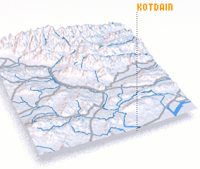 Places with similar names to Kot Dāin, Pakistan ::
Disclaimer :: Information on this page comes without warranty of any kind |
||
|
Where is Kot Dāin? Elevation and coordinates ::
Latitude (lat): 33°0'1"N Longitude (lon): 70°36'50"E
Elevation (approx.): 374m (map arrows pan, magnifying glasses zoom) |
||
|
Visiting Kot Dāin? Hotel/Accommodation ::
Book a hotel in Kot Dāin Travel Guide ::
Buy a travel guide for Pakistan rental cars ::
car rental offers GPS waypoint ::
download a GPX waypoint (PoI) of Kot Dāin for your GPS receiver
|
||