|
search place name
|
||
Laghūno Tang (Federally Administered Tribal Areas, Pakistan)Laghūno Tang is a town in the Federally Administered Tribal Areas region of Pakistan. An overview map of the region around Laghūno Tang is displayed below.
regional and 3d topo map of Laghūno Tang, Pakistan ::

Laghūno Tang airports ::
The nearest airport is JAA - Jalalabad, located 83.4 km north of Laghūno Tang.
Other airports nearby include PEW - Peshawar Intl (109.3 km east), KBL - Kabul Intl (149.8 km north west), SDT - Saidu Sharif (220.8 km north east), Nearby towns ::
Gwākai Star Kili (0.5km north) //
Sarkhawa Darra (2.1km south) //
Khāo (2.1km east) //
Bāgh (2.6km east) //
Tindoh (4.4km north) //
Zarīf Khān Kot (3.8km east) //
Mazrīna (4.5km north east) //
Ut (4.4km east) //
Adu Kili (5.0km north east) //
Shagai (5.4km north east) //
Bāzah (6.3km south) //
Krumb (6.1km north east) //
Masul (5.7km south east) //
Zangai (5.8km east) //
Jaossai (5.9km east) //
Jalamai (6.2km south west) //
Mīr Bāgh (7.3km north) //
Nararai (6.4km south west) //
Jarana (7.4km south) //
Bakhtāwar Muqām Ziārat (6.5km east) //
Nararai (7.4km south west) //
Tātang (6.8km north east) //
Zāokai (7.7km south east) //
Chinār Kili (7.8km north east) //
Satin (8.2km north west) //
Jabba (7.4km east) //
Badāma (8.9km north) //
Ghuliāngo (7.7km north east) //
Manatu (8.1km south east) //
[all distances 'as the bird flies' and approximate] 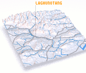 Places with similar names to Laghūno Tang, Pakistan :: Disclaimer :: Information on this page comes without warranty of any kind |
||
|
Where is Laghūno Tang? Elevation and coordinates ::
Latitude (lat): 33°39'6"N Longitude (lon): 70°24'25"E
Elevation (approx.): 1359m (map arrows pan, magnifying glasses zoom) |
||
|
Visiting Laghūno Tang? Hotel/Accommodation ::
Book a hotel in Laghūno Tang Travel Guide ::
Buy a travel guide for Pakistan rental cars ::
car rental offers GPS waypoint ::
download a GPX waypoint (PoI) of Laghūno Tang for your GPS receiver
|
||