|
search place name
|
||
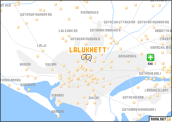
Lalūkhet (Sind, Pakistan)Lalūkhet is a town in the Sind region of Pakistan. An overview map of the region around Lalūkhet is displayed below.
regional and 3d topo map of Lalūkhet, Pakistan ::
Lalūkhet airports ::
The nearest airport is KHI - Karachi Jinnah Intl, located 12.9 km east of Lalūkhet.
Other airports nearby include BDN - Talhar (182.5 km east), WNS - Nawabshah (199.9 km north east), Nearby towns ::
Goth Masto (0.0km north) //
Goth Jugbān (0.0km north) //
Kānji Bāgh (0.0km north) //
Goth Kesari (0.0km north) //
Pīrābād (0.0km north) //
Lālūkhet (0.9km east) //
Golimār (1.5km south west) //
Nazimābād (1.7km north west) //
Goth Thāra (1.7km south west) //
Garden West (1.8km south west) //
Goth Wadūd (1.7km west) //
Āmil Colony (1.9km south) //
Goth Nagmān (1.7km east) //
Goth Mūsa Gado (1.9km north) //
Garden East (1.9km south) //
Liaquatābād (1.9km north east) //
New Town (2.2km south east) //
Gandhi Gardens (2.5km south west) //
Goth Goli Mār (2.5km south west) //
Dakhsar (2.7km south west) //
Pārsi Colony (3.0km south) //
Ramswamy Quarters (3.2km south) //
Quāidābād (3.2km south) //
Federal Area (3.2km north east) //
Jacob Lines (3.5km south) //
Bahādurābād (3.4km south east) //
Goth Khāndo Gado (3.7km north) //
Goth Allāhdād Khān (3.5km north east) //
Goth Warayo Gado (3.4km east) //
[all distances 'as the bird flies' and approximate]  Places with similar names to Lalūkhet, Pakistan ::
// Lālūkhet (PK)
Disclaimer :: Information on this page comes without warranty of any kind |
||
|
Where is Lalūkhet? Elevation and coordinates ::
Latitude (lat): 24°54'0"N Longitude (lon): 67°2'0"E
Elevation (approx.): 20m (map arrows pan, magnifying glasses zoom) |
||
|
Visiting Lalūkhet? Hotel/Accommodation ::
Book a hotel in Lalūkhet Travel Guide ::
Buy a travel guide for Pakistan rental cars ::
car rental offers GPS waypoint ::
download a GPX waypoint (PoI) of Lalūkhet for your GPS receiver
|
||