|
search place name
|
||
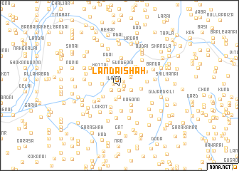
Landai Shāh (Punjab, Pakistan)Landai Shāh is a town in the Punjab region of Pakistan. An overview map of the region around Landai Shāh is displayed below.
regional and 3d topo map of Landai Shāh, Pakistan ::
Landai Shāh airports ::
The nearest airport is SDT - Saidu Sharif, located 18.3 km west of Landai Shāh.
Other airports nearby include MFG - Muzaffarabad (104.1 km south east), PEW - Peshawar Intl (133.8 km south west), ISB - Islamabad Chaklala (145.0 km south), RAZ - Rawala Kot Rawalakot (159.0 km south east), Nearby towns ::
Kashora (0.6km east) //
Nocha (0.8km south) //
Lodia (0.8km north east) //
Tor Tūt (0.8km south east) //
Ilānai (0.8km west) //
Mūrai (1.3km south west) //
Malam (1.9km south) //
Gul Paiza (1.7km south east) //
Ashārai (1.9km north east) //
Shaltālu (2.1km north) //
Charai (2.2km south) //
Shīnkad (2.5km north) //
Nandoka (2.4km north east) //
Khadarzopatai (2.3km west) //
Sur Derai (2.8km north) //
Shagai (2.7km south west) //
Spīn Obo (2.8km east) //
Kasona (3.4km south east) //
Khwārpalai (3.6km south) //
Kākot (3.6km north east) //
Mattai (3.4km north west) //
Tuwa (3.4km north west) //
Sipar (3.5km south west) //
Tambāgat (4.0km south) //
Ganājīri (4.3km north) //
Achro Bānda (3.6km east) //
Gishār (4.3km south) //
Adai (4.3km north) //
Kūh (4.3km south) //
[all distances 'as the bird flies' and approximate] 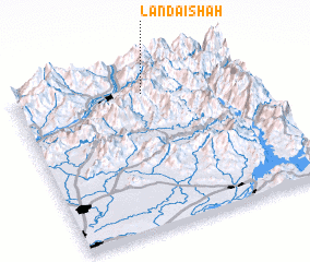 Places with similar names to Landai Shāh, Pakistan ::
Disclaimer :: Information on this page comes without warranty of any kind |
||
|
Where is Landai Shāh? Elevation and coordinates ::
Latitude (lat): 34°50'30"N Longitude (lon): 72°33'0"E
Elevation (approx.): 1531m (map arrows pan, magnifying glasses zoom) |
||
|
Visiting Landai Shāh? Hotel/Accommodation ::
Book a hotel in Landai Shāh Travel Guide ::
Buy a travel guide for Pakistan rental cars ::
car rental offers GPS waypoint ::
download a GPX waypoint (PoI) of Landai Shāh for your GPS receiver
|
||