|
search place name
|
||
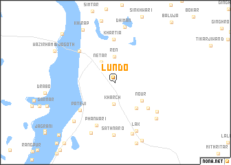
Lundo (Sind, Pakistan)Lundo is a town in the Sind region of Pakistan. An overview map of the region around Lundo is displayed below.
regional and 3d topo map of Lundo, Pakistan ::
Lundo airports ::
The nearest airport is WNS - Nawabshah, located 94.0 km south west of Lundo.
Other airports nearby include SKZ - Sukkur (101.0 km north), MJD - Moenjodaro (104.3 km north west), JSA - Jaisalmer (181.8 km east), SUL - Sui (200.8 km north), Nearby towns ::
Kharch (3.6km south) //
Netar (3.8km north west) //
Ren (4.2km north) //
Nour (4.8km south east) //
Turko (5.2km south east) //
Ghopa Tar (6.3km south east) //
Khārtia (7.0km north) //
Pāteji (6.8km south west) //
Phānwāri (7.5km south) //
Tajjal (7.3km north west) //
Lanbāro (7.7km south east) //
Sāthnāro (8.5km south) //
Lak (8.4km south) //
Dori (8.7km south) //
Khinju Tor (8.3km south east) //
Kāthgarh (8.9km south west) //
Mir Mulla (8.8km south west) //
Khirāp (9.7km north west) //
Doda Mehrbar (11.0km north west) //
[all distances 'as the bird flies' and approximate] 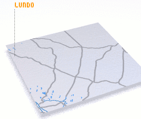 Places with similar names to Lundo, Pakistan ::
Disclaimer :: Information on this page comes without warranty of any kind |
||
|
Where is Lundo? Elevation and coordinates ::
Latitude (lat): 26°50'15"N Longitude (lon): 69°2'10"E
Elevation (approx.): 45m (map arrows pan, magnifying glasses zoom) |
||
|
Visiting Lundo? Hotel/Accommodation ::
Book a hotel in Lundo Travel Guide ::
Buy a travel guide for Pakistan rental cars ::
car rental offers GPS waypoint ::
download a GPX waypoint (PoI) of Lundo for your GPS receiver
|
||