|
search place name
|
||
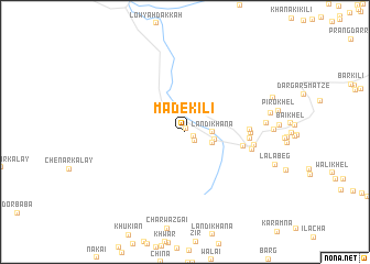
Made Kili (Federally Administered Tribal Areas, Pakistan)Made Kili is a town in the Federally Administered Tribal Areas region of Pakistan. An overview map of the region around Made Kili is displayed below.
regional and 3d topo map of Made Kili, Pakistan ::
Made Kili airports ::
The nearest airport is PEW - Peshawar Intl, located 42.1 km east of Made Kili.
Other airports nearby include JAA - Jalalabad (62.4 km north west), SDT - Saidu Sharif (140.2 km north east), KBL - Kabul Intl (179.2 km west), Nearby towns ::
Towr Kham (0.4km north) //
Morgai Kili (0.9km south east) //
Khargali (1.2km south east) //
Landi Khāna (2.3km east) //
Chārbāgh Fort (2.6km south east) //
Badshāh Men (2.6km east) //
Gāgra (5.1km east) //
Fātmi Khel (5.4km east) //
Kando Khel (5.5km east) //
Āshaq Khel (5.5km east) //
Qāfila Sarāi (5.9km east) //
Landi Kotal (6.0km east) //
Ash Khel (6.9km east) //
Mukhtār Khel (7.4km east) //
[all distances 'as the bird flies' and approximate]  Places with similar names to Made Kili, Pakistan ::
Disclaimer :: Information on this page comes without warranty of any kind |
||
|
Where is Made Kili? Elevation and coordinates ::
Latitude (lat): 34°6'48"N Longitude (lon): 71°4'55"E
Elevation (approx.): 1171m (map arrows pan, magnifying glasses zoom) |
||
|
Visiting Made Kili? Hotel/Accommodation ::
Book a hotel in Made Kili Travel Guide ::
Buy a travel guide for Pakistan rental cars ::
car rental offers GPS waypoint ::
download a GPX waypoint (PoI) of Made Kili for your GPS receiver
|
||