|
search place name
|
||
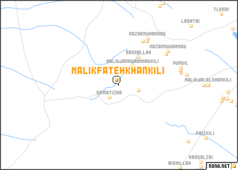
Malik Fateh Khān Kili (Balochistān, Pakistan)Malik Fateh Khān Kili is a town in the Balochistān region of Pakistan. An overview map of the region around Malik Fateh Khān Kili is displayed below.
regional and 3d topo map of Malik Fateh Khān Kili, Pakistan ::
Malik Fateh Khān Kili airports ::
The nearest airport is UET - Quetta, located 63.8 km south east of Malik Fateh Khān Kili.
Other airports nearby include KDH - Kandahar (114.8 km north west), Nearby towns ::
Spīnatīzha (2.3km south west) //
Malik Nazar Muhammad Kili (2.9km east) //
Malik Jān Muhammad Kili (3.5km north east) //
Nasrullāh (5.1km north east) //
Karm (7.6km north east) //
Mān Gul (7.8km north east) //
Nazar Muhammad (8.3km north east) //
Khwargai (8.1km north east) //
Nazar Muhammad (8.6km north east) //
[all distances 'as the bird flies' and approximate]  Places with similar names to Malik Fateh Khān Kili, Pakistan :: Disclaimer :: Information on this page comes without warranty of any kind |
||
|
Where is Malik Fateh Khān Kili? Elevation and coordinates ::
Latitude (lat): 30°35'4"N Longitude (lon): 66°23'47"E
Elevation (approx.): 1877m (map arrows pan, magnifying glasses zoom) |
||
|
Visiting Malik Fateh Khān Kili? Hotel/Accommodation ::
Book a hotel in Malik Fateh Khān Kili Travel Guide ::
Buy a travel guide for Pakistan rental cars ::
car rental offers GPS waypoint ::
download a GPX waypoint (PoI) of Malik Fateh Khān Kili for your GPS receiver
|
||