|
search place name
|
||
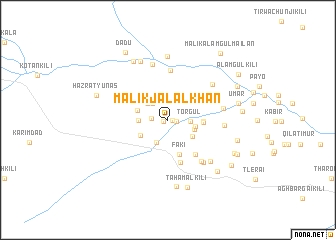
Malik Jalāl Khān (Balochistān, Pakistan)Malik Jalāl Khān is a town in the Balochistān region of Pakistan. An overview map of the region around Malik Jalāl Khān is displayed below.
regional and 3d topo map of Malik Jalāl Khān, Pakistan ::
Malik Jalāl Khān airports ::
The nearest airport is PZH - Zhob, located 130.2 km north east of Malik Jalāl Khān.
Other airports nearby include UET - Quetta (141.7 km south west), Nearby towns ::
Malik Wazir (0.4km east) //
Mazwi (0.4km west) //
Sultan Kili (0.8km east) //
Malik Muhammad Rasul (1.6km west) //
Torgul (2.1km east) //
Mulla Majid (2.4km north west) //
Muhammad Burj (2.7km south west) //
Malik Nahak Mailan (2.7km north west) //
Kadar (2.7km south east) //
Wahāb (2.8km east) //
Miān Khān (2.8km west) //
Ata Muhammad Kili (3.0km south east) //
Hāji Sāhib (3.2km south west) //
Hāji Muhammad Wali Mailan (3.1km west) //
Mulla Ali (3.5km east) //
Shams-ud-din (3.5km east) //
Faki (4.0km south) //
Barān (4.7km south east) //
Lazad (4.9km south) //
Bashīr (5.6km north) //
Kaudinge (5.6km south east) //
Ashik (5.9km south east) //
Mirza Khān (5.5km east) //
Saiyid Rahmat (5.5km east) //
Ziārat Manjara (5.8km north east) //
Brāhmad (6.3km north) //
Fazalband (6.2km south east) //
Abdul Qādir Mailan (7.1km north) //
Malik Lālhān Mailan (7.0km north) //
[all distances 'as the bird flies' and approximate]  Places with similar names to Malik Jalāl Khān, Pakistan :: Disclaimer :: Information on this page comes without warranty of any kind |
||
|
Where is Malik Jalāl Khān? Elevation and coordinates ::
Latitude (lat): 30°45'0"N Longitude (lon): 68°17'50"E
Elevation (approx.): 1561m (map arrows pan, magnifying glasses zoom) |
||
|
Visiting Malik Jalāl Khān? Hotel/Accommodation ::
Book a hotel in Malik Jalāl Khān Travel Guide ::
Buy a travel guide for Pakistan rental cars ::
car rental offers GPS waypoint ::
download a GPX waypoint (PoI) of Malik Jalāl Khān for your GPS receiver
|
||