|
search place name
|
||
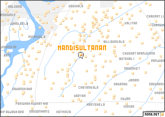
Mandi Sultānan (Punjab, Pakistan)Mandi Sultānan is a town in the Punjab region of Pakistan. An overview map of the region around Mandi Sultānan is displayed below.
regional and 3d topo map of Mandi Sultānan, Pakistan ::
Mandi Sultānan airports ::
The nearest airport is LYP - Faisalabad Intl, located 78.7 km north east of Mandi Sultānan.
Other airports nearby include MUX - Multan Intl (123.6 km south west), Nearby towns ::
Chahgrāni Bhaini (0.8km north east) //
Chāh Nawān (1.0km north) //
Sherwāla (1.4km west) //
Basti Haveliwāla (1.8km north) //
Budharwāli (2.2km north) //
Tahliwāla (2.0km east) //
Mardānwāla (2.5km north) //
Bhāini Nunānwāla (2.4km north east) //
Bhaini Baluchān (2.3km east) //
Rustam Sargāna (2.4km north west) //
Kadyanewāli (2.6km north west) //
Chāh Chuhrewāla (2.9km south) //
Nathuwāla (3.2km north) //
Deriwāla (2.9km south west) //
Gadgarānwāla (3.0km south east) //
Chāh Guriānwāla (3.9km north) //
Pīrwāla (3.7km south east) //
Ahmadwāla (3.7km south west) //
Chāh Doratta (3.6km east) //
Ghāzi Khanani (4.2km north) //
Nabūwāla (4.1km north west) //
Takia Gilmāla (4.3km north) //
Jandwāla (4.1km south west) //
Basti Kamiāni (4.5km north) //
Dittawāla (4.6km south west) //
Ghāziwāla (4.4km south east) //
Jagguwāli (4.9km south east) //
Gilmāla (5.2km north) //
Budhwāla (4.5km east) //
[all distances 'as the bird flies' and approximate]  Places with similar names to Mandi Sultānan, Pakistan :: Disclaimer :: Information on this page comes without warranty of any kind |
||
|
Where is Mandi Sultānan? Elevation and coordinates ::
Latitude (lat): 31°3'11"N Longitude (lon): 72°15'11"E
Elevation (approx.): 148m (map arrows pan, magnifying glasses zoom) |
||
|
Visiting Mandi Sultānan? Hotel/Accommodation ::
Book a hotel in Mandi Sultānan Travel Guide ::
Buy a travel guide for Pakistan rental cars ::
car rental offers GPS waypoint ::
download a GPX waypoint (PoI) of Mandi Sultānan for your GPS receiver
|
||