|
search place name
|
||
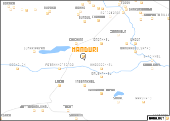
Mandūri (North-West Frontier, Pakistan)Mandūri is a town in the North-West Frontier region of Pakistan. An overview map of the region around Mandūri is displayed below.
regional and 3d topo map of Mandūri, Pakistan ::
Mandūri airports ::
The nearest airport is PEW - Peshawar Intl, located 63.4 km north of Mandūri.
Other airports nearby include JAA - Jalalabad (134.9 km north west), ISB - Islamabad Chaklala (160.7 km east), SDT - Saidu Sharif (177.3 km north east), Nearby towns ::
Khaddar Khel (3.6km south east) //
Chichina (4.0km north west) //
Galsha Khel (4.8km south east) //
Gada Khel (4.8km north east) //
Māssan Khel (5.6km south) //
Fateh Khān Bānda (5.0km west) //
Lāchi (7.2km south west) //
Bānda Bhatiāran (8.0km south east) //
Sūrgul (8.6km north) //
Zara Mela (8.3km north east) //
Chāmbāi (9.1km north) //
[all distances 'as the bird flies' and approximate] 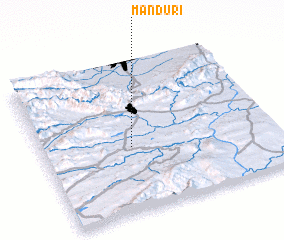 Places with similar names to Mandūri, Pakistan ::
Disclaimer :: Information on this page comes without warranty of any kind |
||
|
Where is Mandūri? Elevation and coordinates ::
Latitude (lat): 33°26'0"N Longitude (lon): 71°23'0"E
Elevation (approx.): 462m (map arrows pan, magnifying glasses zoom) |
||
|
Visiting Mandūri? Hotel/Accommodation ::
Book a hotel in Mandūri Travel Guide ::
Buy a travel guide for Pakistan rental cars ::
car rental offers GPS waypoint ::
download a GPX waypoint (PoI) of Mandūri for your GPS receiver
|
||