|
search place name
|
||
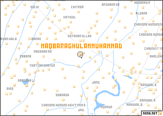
Maqbara Ghulām Muhammad (Punjab, Pakistan)Maqbara Ghulām Muhammad is a town in the Punjab region of Pakistan. An overview map of the region around Maqbara Ghulām Muhammad is displayed below.
regional and 3d topo map of Maqbara Ghulām Muhammad, Pakistan ::
Maqbara Ghulām Muhammad airports ::
The nearest airport is LYP - Faisalabad Intl, located 69.2 km south east of Maqbara Ghulām Muhammad.
Other airports nearby include LHE - Lahore Allama Iqbal Intl (185.1 km east), MUX - Multan Intl (204.7 km south west), ISB - Islamabad Chaklala (208.9 km north), Nearby towns ::
Jahānewāla (1.2km north) //
Chak One Hundred Forty-four NB (1.6km east) //
Chak One Hundred Forty-sevenNB (1.9km south) //
Chak Rājgarh (2.6km north west) //
Chak One Hundred Thirty-three NB (3.1km south) //
Chak One Hundred Forty-three NB (2.7km east) //
Subedār Rang Shāhwāla (3.7km north) //
Kot Amanullah (3.9km north) //
Jahānewāla (4.1km north) //
Chak One Hundred Twenty-nine NB (3.7km north east) //
Chak One Hundred Thirty-four NB (4.6km south) //
Chak One Hundred Thirty-one NB (4.3km south east) //
Chak One Hundred Forty-nine NB (4.5km south west) //
Chak One Hundred Thirty NB (5.0km east) //
Chak One Hundred Forty-six NB (5.6km south west) //
Chak One Hundred Twenty-seven NB (5.5km north east) //
Kālriānwāla (6.1km north) //
Chak Ghulām Muhammad (6.2km north) //
Thatta Muhammad Panāh (5.4km west) //
Chak One Hundred Forty-one NB (6.1km south east) //
Chak One Hundred Twenty-five NB (6.5km north east) //
Chak One Hundred Thirty-five (6.8km south) //
Sillānwāli (6.1km north east) //
Chak One Hundred Forty-two (7.0km south) //
Chak One Hundred Thirty-two NB (6.4km south east) //
Nawān Log (7.2km north) //
Shergarh (6.7km north west) //
Chak One Hundred Twenty-six NB (6.9km north east) //
Jang (7.4km south east) //
[all distances 'as the bird flies' and approximate] 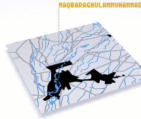 Places with similar names to Maqbara Ghulām Muhammad, Pakistan :: Disclaimer :: Information on this page comes without warranty of any kind |
||
|
Where is Maqbara Ghulām Muhammad? Elevation and coordinates ::
Latitude (lat): 31°48'25"N Longitude (lon): 72°28'50"E
Elevation (approx.): 170m (map arrows pan, magnifying glasses zoom) |
||
|
Visiting Maqbara Ghulām Muhammad? Hotel/Accommodation ::
Book a hotel in Maqbara Ghulām Muhammad Travel Guide ::
Buy a travel guide for Pakistan rental cars ::
car rental offers GPS waypoint ::
download a GPX waypoint (PoI) of Maqbara Ghulām Muhammad for your GPS receiver
|
||