|
search place name
|
||
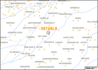
Matwāla (Punjab, Pakistan)Matwāla is a town in the Punjab region of Pakistan. An overview map of the region around Matwāla is displayed below.
regional and 3d topo map of Matwāla, Pakistan ::
Matwāla airports ::
The nearest airport is LYP - Faisalabad Intl, located 153.6 km north west of Matwāla.
Other airports nearby include LHE - Lahore Allama Iqbal Intl (158.1 km north), ATQ - Amritsar (192.7 km north east), Nearby towns ::
Ratti Rām (2.5km south west) //
Qāsimwāla (3.7km south) //
Sobhāwāla (3.7km north) //
Madhāniwāla (3.7km north east) //
Pharmānwāla (4.0km north west) //
Lāhūra (4.9km south east) //
Chopālia (5.8km north) //
Bāhu Sārhu (5.8km south) //
Fatuhi (6.4km south west) //
Jorki Hashmat (6.1km north west) //
Tebqara (6.4km west) //
Hinnūnwāla (7.6km north) //
Jammu (7.6km south) //
Jorki Sikhkhān (6.7km west) //
Chhatteke (6.7km east) //
Fatehgarh (8.1km north west) //
Bholewāla (8.5km south west) //
Lāchharīwāla (8.8km north west) //
Manha Sri Rām (9.0km north east) //
Khilchi Balochiniān (9.4km north) //
Sajāwalpur (8.9km south east) //
Nānaksar (9.8km north west) //
Suchcha Singhwāla (10.2km north east) //
Ukānwāla (10.3km north west) //
Tajāna (10.6km south west) //
[all distances 'as the bird flies' and approximate]  Places with similar names to Matwāla, Pakistan ::
Disclaimer :: Information on this page comes without warranty of any kind |
||
|
Where is Matwāla? Elevation and coordinates ::
Latitude (lat): 30°11'0"N Longitude (lon): 73°50'0"E
Elevation (approx.): 173m (map arrows pan, magnifying glasses zoom) |
||
|
Visiting Matwāla? Hotel/Accommodation ::
Book a hotel in Matwāla Travel Guide ::
Buy a travel guide for Pakistan rental cars ::
car rental offers GPS waypoint ::
download a GPX waypoint (PoI) of Matwāla for your GPS receiver
|
||