|
search place name
|
||
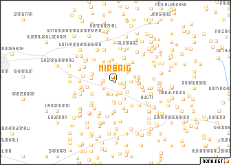
Mīr Baig (Sind, Pakistan)Mīr Baig is a town in the Sind region of Pakistan. An overview map of the region around Mīr Baig is displayed below.
regional and 3d topo map of Mīr Baig, Pakistan ::
Mīr Baig airports ::
The nearest airport is WNS - Nawabshah, located 17.8 km west of Mīr Baig.
Other airports nearby include MJD - Moenjodaro (131.8 km north), BDN - Talhar (153.8 km south), SKZ - Sukkur (169.2 km north), KHI - Karachi Jinnah Intl (202.0 km south west), Nearby towns ::
Hāji Khuda Bakhsh Brāhui (0.7km east) //
Ghulām Haider (1.2km east) //
Allāh Dino Magsi (1.5km south east) //
Chaudhry Pīr Muhammad (1.8km south) //
Lashkāri Magsi Brāhui (2.0km south) //
Mardhāri (1.8km west) //
Lashkari Khān (2.0km south west) //
Hāji Daūd (2.1km south) //
Gupchāni (2.0km south west) //
Ali Bakhsh Khokhar (2.2km south west) //
Ibrāhīm Brāhui (2.1km west) //
Hāji Mirza (2.3km south east) //
Abdul Hamīd Qureshi (2.2km east) //
Muhammad Khān (2.5km north east) //
Muhammad Afzal Pathān (2.9km north) //
Sālo Hajām (2.9km south east) //
Gul Hasan Siāl (3.1km south) //
Haji Ramzān Magsi (2.9km east) //
Hāji Gul Muhammad (3.2km south) //
Sājan (3.3km south) //
Hāji Ghulām Haider (3.4km north east) //
Darya Khān Magsi (3.2km east) //
Hāji Firdaus Pathān (3.5km north) //
Bhāi Khān Magsi (3.3km east) //
Tāj Muhammad Pathān (3.7km north) //
Abbās Kirio (3.4km east) //
Bāndi Brāhui (3.5km east) //
Billa Khān Magsi (3.5km east) //
Hāji Nazīr Muhammad (3.8km north west) //
[all distances 'as the bird flies' and approximate]  Places with similar names to Mīr Baig, Pakistan ::
// Marbeck (DE)
// Meerbeck (DE)
// Meerbeck (DE)
// Merbeck (DE)
// Moorbek (DE)
// Meiribakki (IS)
// Mīrah Bak (IQ)
// Morobogo (BF)
// Muri Baihk (IN)
// Moribougou (MR)
Disclaimer :: Information on this page comes without warranty of any kind |
||
|
Where is Mīr Baig? Elevation and coordinates ::
Latitude (lat): 26°12'30"N Longitude (lon): 68°34'5"E
Elevation (approx.): 29m (map arrows pan, magnifying glasses zoom) |
||
|
Visiting Mīr Baig? Hotel/Accommodation ::
Book a hotel in Mīr Baig Travel Guide ::
Buy a travel guide for Pakistan rental cars ::
car rental offers GPS waypoint ::
download a GPX waypoint (PoI) of Mīr Baig for your GPS receiver
|
||