|
search place name
|
||
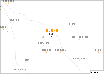
Mubho (Sind, Pakistan)Mubho is a town in the Sind region of Pakistan. An overview map of the region around Mubho is displayed below.
regional and 3d topo map of Mubho, Pakistan ::
Mubho airports ::
The nearest airport is SKZ - Sukkur, located 107.6 km north west of Mubho.
Other airports nearby include WNS - Nawabshah (126.9 km south west), MJD - Moenjodaro (133.0 km west), JSA - Jaisalmer (145.6 km east), RYK - Rahim Yar Khan Sheikh Zayed (184.3 km north east), Nearby towns ::
Rahmat Khān jo Chara (2.9km west) //
Mirān jo Wand (4.0km south west) //
Goth Khāra (5.9km south) //
Aliwāro Kher (6.2km south east) //
Mundo (7.6km north east) //
[all distances 'as the bird flies' and approximate]  Places with similar names to Mubho, Pakistan ::
Disclaimer :: Information on this page comes without warranty of any kind |
||
|
Where is Mubho? Elevation and coordinates ::
Latitude (lat): 26°55'0"N Longitude (lon): 69°24'0"E
Elevation (approx.): 85m (map arrows pan, magnifying glasses zoom) |
||
|
Visiting Mubho? Hotel/Accommodation ::
Book a hotel in Mubho Travel Guide ::
Buy a travel guide for Pakistan rental cars ::
car rental offers GPS waypoint ::
download a GPX waypoint (PoI) of Mubho for your GPS receiver
|
||