|
search place name
|
||
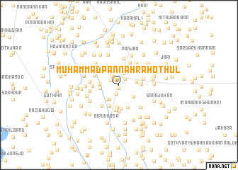
Muhammad Pannāh Rāho Thul (Sind, Pakistan)Muhammad Pannāh Rāho Thul is a town in the Sind region of Pakistan. An overview map of the region around Muhammad Pannāh Rāho Thul is displayed below.
regional and 3d topo map of Muhammad Pannāh Rāho Thul, Pakistan ::
Muhammad Pannāh Rāho Thul airports ::
The nearest airport is WNS - Nawabshah, located 37.7 km south east of Muhammad Pannāh Rāho Thul.
Other airports nearby include MJD - Moenjodaro (97.7 km north), SKZ - Sukkur (155.6 km north east), BDN - Talhar (192.8 km south), KHI - Karachi Jinnah Intl (196.5 km south west), Nearby towns ::
Jagpāl (0.5km south) //
Thul (0.5km south) //
Āqil Rāho (1.2km north east) //
Hāji Khān Muhammad Rāho (1.3km north west) //
Goth Chaubandi (1.5km south) //
Muhammad Khān Rāho (1.6km north west) //
Muhammad Khān Rāho (1.7km north west) //
Bahādur Khān Dāhri (2.0km north) //
Allāh Ditto Kalyār (2.7km south west) //
Mitho Kalyār (2.5km east) //
Sattār Ali Dāhri (2.7km north west) //
Chabbar Dāhri (2.8km south east) //
Mirukan (2.8km south west) //
Amīr Shāh (2.7km west) //
Muhammad Sulaiman Rāho (2.8km west) //
Safrāni Hoteputa (3.3km north west) //
Sūmar Khān Nohāj (3.2km east) //
Saddīq Rāho (3.6km south) //
Muhammad Kalyār (3.5km south west) //
Qāzi Yūsuf Bhatti (3.7km south) //
Gul Muhammad Dāhri (3.8km south) //
Mewa Parhār (3.4km east) //
Wali Muhammad Khān Rind (3.9km north east) //
Ādal Kalyār (4.0km south) //
Hāji Ahmad Hoteputa (3.8km north west) //
Wattu (4.2km south) //
Bachu Rāho (3.7km west) //
Panjba (4.2km north) //
Hāji Dhani Bakhsh Khosa (4.1km south west) //
[all distances 'as the bird flies' and approximate]  Places with similar names to Muhammad Pannāh Rāho Thul, Pakistan :: Disclaimer :: Information on this page comes without warranty of any kind |
||
|
Where is Muhammad Pannāh Rāho Thul? Elevation and coordinates ::
Latitude (lat): 26°27'15"N Longitude (lon): 68°7'0"E
Elevation (approx.): 36m (map arrows pan, magnifying glasses zoom) |
||
|
Visiting Muhammad Pannāh Rāho Thul? Hotel/Accommodation ::
Book a hotel in Muhammad Pannāh Rāho Thul Travel Guide ::
Buy a travel guide for Pakistan rental cars ::
car rental offers GPS waypoint ::
download a GPX waypoint (PoI) of Muhammad Pannāh Rāho Thul for your GPS receiver
|
||