|
search place name
|
||
Murgha (Balochistān, Pakistan)Murgha is a town in the Balochistān region of Pakistan. An overview map of the region around Murgha is displayed below.
regional and 3d topo map of Murgha, Pakistan ::

Murgha airports ::
The nearest airport is UET - Quetta, located 100.1 km south west of Murgha.
Other airports nearby include PZH - Zhob (171.4 km north east), KDH - Kandahar (207.3 km north west), Nearby towns ::
Sra Salawāt (0.8km north west) //
Aklās Zaregai (1.0km south) //
Naghza (2.7km south east) //
Ucha Tāki (4.1km north east) //
Romezh (4.6km north east) //
Ghazgai (4.7km south east) //
Nāik (5.1km north west) //
Kharāba (5.7km north east) //
Naudeh Taki (5.9km south east) //
Hamrāni (5.8km west) //
Barka (7.1km south) //
Past Gwazhe (7.1km north east) //
Marzaghān (8.1km south east) //
Izar Kas (7.4km west) //
Ziāba (9.0km south) //
Bāshai (9.4km south) //
Khalīl Kach (8.7km south west) //
Sariwar Zaromba (9.8km south east) //
Sūr Samuz (10.6km south east) //
[all distances 'as the bird flies' and approximate] 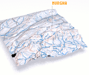 Places with similar names to Murgha, Pakistan ::
Disclaimer :: Information on this page comes without warranty of any kind |
||
|
Where is Murgha? Elevation and coordinates ::
Latitude (lat): 30°43'38"N Longitude (lon): 67°49'27"E
Elevation (approx.): 2067m (map arrows pan, magnifying glasses zoom) |
||
|
Visiting Murgha? Hotel/Accommodation ::
Book a hotel in Murgha Travel Guide ::
Buy a travel guide for Pakistan rental cars ::
car rental offers GPS waypoint ::
download a GPX waypoint (PoI) of Murgha for your GPS receiver
|
||