|
search place name
|
||
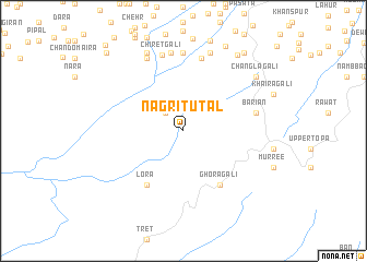
Nagri Tutāl (North-West Frontier, Pakistan)Nagri Tutāl is a town in the North-West Frontier region of Pakistan. An overview map of the region around Nagri Tutāl is displayed below.
regional and 3d topo map of Nagri Tutāl, Pakistan ::
Nagri Tutāl airports ::
The nearest airport is ISB - Islamabad Chaklala, located 40.5 km south west of Nagri Tutāl.
Other airports nearby include RAZ - Rawala Kot Rawalakot (45.5 km east), MFG - Muzaffarabad (48.4 km north), SDT - Saidu Sharif (131.9 km north west), SXR - Srinagar (134.9 km east), Nearby towns ::
Māri (2.4km north west) //
Ghora Gali (6.4km south east) //
Lora (6.4km south west) //
Bāriān (6.4km east) //
Tupla (7.6km north) //
Chiret Gali (7.9km north) //
Danna Kāgiār (8.0km north) //
Nagri Tarli (8.1km north) //
Sajkot (8.0km north west) //
Thunda (8.4km north) //
Sajkot Gali (8.6km north) //
Chāngla Gali (8.3km north east) //
Maira (9.0km north east) //
Tajwāl Utli (9.4km north east) //
Retri Gali (9.5km north east) //
Kalanda (10.4km north west) //
Mohri Badbhain (11.0km north west) //
[all distances 'as the bird flies' and approximate] 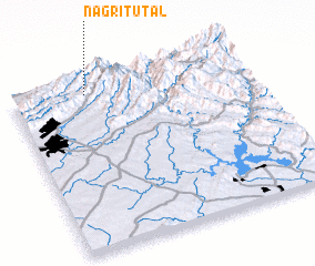 Places with similar names to Nagri Tutāl, Pakistan :: Disclaimer :: Information on this page comes without warranty of any kind |
||
|
Where is Nagri Tutāl? Elevation and coordinates ::
Latitude (lat): 33°56'0"N Longitude (lon): 73°19'0"E
Elevation (approx.): 1268m (map arrows pan, magnifying glasses zoom) |
||
|
Visiting Nagri Tutāl? Hotel/Accommodation ::
Book a hotel in Nagri Tutāl Travel Guide ::
Buy a travel guide for Pakistan rental cars ::
car rental offers GPS waypoint ::
download a GPX waypoint (PoI) of Nagri Tutāl for your GPS receiver
|
||