|
search place name
|
||
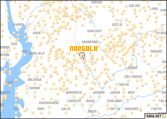
Nargāla (Punjab, Pakistan)Nargāla is a town in the Punjab region of Pakistan. An overview map of the region around Nargāla is displayed below.
regional and 3d topo map of Nargāla, Pakistan ::
Nargāla airports ::
The nearest airport is MFG - Muzaffarabad, located 49.7 km east of Nargāla.
Other airports nearby include ISB - Islamabad Chaklala (77.7 km south), SDT - Saidu Sharif (79.6 km north west), RAZ - Rawala Kot Rawalakot (91.9 km south east), PEW - Peshawar Intl (138.6 km west), Nearby towns ::
Degri (0.3km east) //
Bāndi (0.5km south) //
Salāiāh (0.6km south) //
Zāda Doga (0.7km north west) //
Mohār Urārla (0.8km north west) //
Mohār Pārla (1.0km north) //
Salāiāh Saiyidān (1.2km south west) //
Hotar Mundi (1.4km south) //
Hāl (1.3km east) //
Dheriān (1.5km north west) //
Bāndi (1.5km west) //
Sher Bānda (1.6km east) //
Chahoja (1.6km east) //
Rari (1.9km north west) //
Buchedi Bāndi (1.7km east) //
Sadab (2.1km south east) //
Karki (1.8km west) //
Kalābai (2.0km north east) //
Shaikhwāl (1.9km south east) //
Kalwāl (1.9km north east) //
Miāndi Bāndi (1.9km west) //
Mundi (2.2km south) //
Dher (2.0km north west) //
Jat (2.3km north) //
Mālān (2.3km south west) //
Gandola (2.4km north west) //
Pātal (2.5km south) //
Kotla (2.6km south) //
Manga Doga (2.5km south east) //
[all distances 'as the bird flies' and approximate] 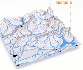 Places with similar names to Nargāla, Pakistan ::
// Néa Iráklia (GR)
// Néa Iráklia (GR)
// Nergul' (RU)
// Nārikeli (BD)
// Nārikeli (BD)
// Nārikeli (BD)
// Nārikeli (BD)
// Nārikuli (BD)
// Nārkeli (BD)
// Narcola (EC)
Disclaimer :: Information on this page comes without warranty of any kind |
||
|
Where is Nargāla? Elevation and coordinates ::
Latitude (lat): 34°18'30"N Longitude (lon): 72°58'10"E
Elevation (approx.): 958m (map arrows pan, magnifying glasses zoom) |
||
|
Visiting Nargāla? Hotel/Accommodation ::
Book a hotel in Nargāla Travel Guide ::
Buy a travel guide for Pakistan rental cars ::
car rental offers GPS waypoint ::
download a GPX waypoint (PoI) of Nargāla for your GPS receiver
|
||