|
search place name
|
||
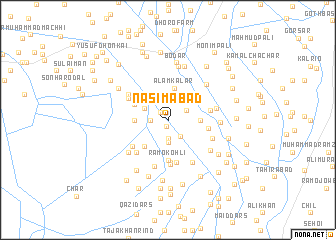
Nasīmābād (Sind, Pakistan)Nasīmābād is a town in the Sind region of Pakistan. An overview map of the region around Nasīmābād is displayed below.
regional and 3d topo map of Nasīmābād, Pakistan ::
Nasīmābād airports ::
The nearest airport is BDN - Talhar, located 82.8 km south west of Nasīmābād.
Other airports nearby include WNS - Nawabshah (159.6 km north west), BHJ - Bhuj (215.1 km south), JSA - Jaisalmer (226.8 km north east), Nearby towns ::
Doctor Majīd Arāīn (0.8km south) //
Kinjhejhi (1.1km north west) //
Muhammad Ilyās Khāskheli (1.7km west) //
Dīnār Māchhi (2.0km south) //
Kheta Kachhi (2.2km south east) //
Salīmābād (2.2km north east) //
Ghulām Siddīq Saiyid (2.5km south) //
Nāsirābād (2.6km north) //
Dodo Khān Khāskheli (2.7km north west) //
Ālam Kalar (3.6km north) //
Shamīmābād (3.4km east) //
Muhammad Sāleh Khāskheli (3.4km west) //
Kinjheji (3.7km north west) //
Muhammad Jāfar Momon (3.8km south west) //
Hāji Qādir Bakhsh Bhurgari (3.8km north west) //
Rāmo Kohli (4.5km south) //
Goth Punjābi (4.2km east) //
Umar Dīn (4.3km east) //
Jummah Thebo (4.8km south) //
Bustān (4.9km south) //
Qāzi Sultān Muhammad (4.7km south west) //
Mansokh Meghwār (5.0km south) //
Hāji Ibrāhīm Khāskheli (4.7km south west) //
Bachal Khān Banglāni (4.6km north west) //
Bachal Khān Banglāni (4.8km north west) //
Muhammad Amīn Sahto (4.9km south east) //
Muhammad Sādiq Kapri (5.4km south) //
Munshi Ghulām Muhammad (5.4km south east) //
Kunri (5.4km south east) //
[all distances 'as the bird flies' and approximate] 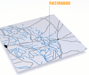 Places with similar names to Nasīmābād, Pakistan ::
Disclaimer :: Information on this page comes without warranty of any kind |
||
|
Where is Nasīmābād? Elevation and coordinates ::
Latitude (lat): 25°13'35"N Longitude (lon): 69°32'30"E
Elevation (approx.): 13m (map arrows pan, magnifying glasses zoom) |
||
|
Visiting Nasīmābād? Hotel/Accommodation ::
Book a hotel in Nasīmābād Travel Guide ::
Buy a travel guide for Pakistan rental cars ::
car rental offers GPS waypoint ::
download a GPX waypoint (PoI) of Nasīmābād for your GPS receiver
|
||