|
search place name
|
||
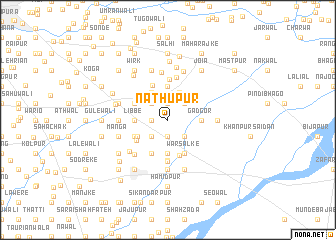
Nāthūpur (Punjab, Pakistan)Nāthūpur is a town in the Punjab region of Pakistan. An overview map of the region around Nāthūpur is displayed below.
regional and 3d topo map of Nāthūpur, Pakistan ::
Nāthūpur airports ::
The nearest airport is IXJ - Jammu, located 33.5 km north of Nāthūpur.
Other airports nearby include ATQ - Amritsar (76.8 km south), IXP - Pathankot (86.9 km east), LHE - Lahore Allama Iqbal Intl (102.3 km south), SXR - Srinagar (176.1 km north), Nearby towns ::
Dulmānwāli (1.6km west) //
Kotli Khādim Shāh (1.6km west) //
Chak Waraich (1.6km west) //
Bakhre Ali (1.9km north) //
Josun (1.9km south) //
Phillora (1.9km south) //
Saboke (1.9km south) //
Wachoke (1.9km south) //
Khānānwāli (2.4km south west) //
Kotli Bagga (2.4km north west) //
Saidānwāla (2.4km north east) //
Maral (2.4km south east) //
Thone (3.3km north) //
Chak Shakūr (3.5km north west) //
Sainewāli (3.7km south) //
Gil (3.1km west) //
Libbe (3.1km west) //
Adowāli (3.7km south) //
Ballowāli (3.7km south) //
Laike (3.7km south) //
Rurki Kalān (3.7km north) //
Gadgor (3.1km east) //
Kotli Jandrān (3.4km south west) //
Kālewāli (4.0km south west) //
Warsālke (4.0km south east) //
Kot Izzat (3.6km south west) //
Chahr (3.6km north west) //
Kot Dāna (4.1km south) //
Ingan (4.1km north) //
[all distances 'as the bird flies' and approximate]  Places with similar names to Nāthūpur, Pakistan ::
Disclaimer :: Information on this page comes without warranty of any kind |
||
|
Where is Nāthūpur? Elevation and coordinates ::
Latitude (lat): 32°24'0"N Longitude (lon): 74°44'0"E
Elevation (approx.): 255m (map arrows pan, magnifying glasses zoom) |
||
|
Visiting Nāthūpur? Hotel/Accommodation ::
Book a hotel in Nāthūpur Travel Guide ::
Buy a travel guide for Pakistan rental cars ::
car rental offers GPS waypoint ::
download a GPX waypoint (PoI) of Nāthūpur for your GPS receiver
|
||