|
search place name
|
||
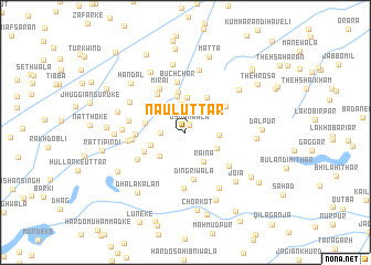
Naul Uttār (Punjab, Pakistan)Naul Uttār is a town in the Punjab region of Pakistan. An overview map of the region around Naul Uttār is displayed below.
regional and 3d topo map of Naul Uttār, Pakistan ::
Naul Uttār airports ::
The nearest airport is LHE - Lahore Allama Iqbal Intl, located 49.5 km north of Naul Uttār.
Other airports nearby include ATQ - Amritsar (86.9 km north east), LYP - Faisalabad Intl (119.6 km west), LUH - Ludhiaha Ludhiana (168.4 km east), IXP - Pathankot (183.8 km north east), Nearby towns ::
Usmānwāla (0.7km north east) //
Rakh Naul (0.9km north) //
Chhīna Uttār (2.2km west) //
Aulakh Uttār (2.8km north) //
Nau Kīta (3.0km north east) //
Chirāghuddinwāla (3.0km east) //
Rāina (3.3km south east) //
Haveli Jhangrānwāli (3.3km south west) //
Wakīlwāla (3.6km north) //
Kāle Uttār (3.2km south east) //
Ganda Singhwāla (3.6km north) //
Sunder Singhwāli (3.3km south west) //
Khushhāal Singhwāla (4.1km north) //
Baghel Singhwāla (4.0km north east) //
Bhāgwānpura (3.6km west) //
Jawāhir Singhwāla (4.1km south west) //
Kot Mirāli Uttār (4.6km north west) //
Dingrīwāla (4.8km south) //
Sidhupura (4.4km north east) //
Mirāi (4.9km north west) //
Sardā-Chet Singhwāla (4.4km west) //
Buchchar (5.1km north) //
Miān Singhwāla (4.7km west) //
Kāle Purāne (5.1km south east) //
Jhuggiān Chhorwāli (5.6km south) //
Khem Singhwāla (5.0km south west) //
Dhāla Khurd (5.1km west) //
Chhucha Bukhna (5.1km west) //
Tara Singhwāla (5.5km west) //
[all distances 'as the bird flies' and approximate] 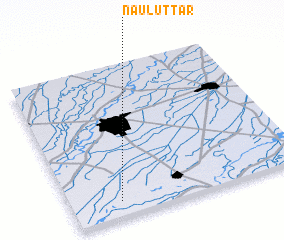 Places with similar names to Naul Uttār, Pakistan ::
// Neu Lutterow (DE)
// Nallıdere (TR)
// Naltri (BD)
// Nāldera (IN)
// Nellatūru (IN)
// Nildori (IN)
// Niladure (LK)
// Nūl Darreh (IR)
// Nŏlta-ri (KP)
// Nŏlta-ri (KP)
Disclaimer :: Information on this page comes without warranty of any kind |
||
|
Where is Naul Uttār? Elevation and coordinates ::
Latitude (lat): 31°6'22"N Longitude (lon): 74°12'49"E
Elevation (approx.): 200m (map arrows pan, magnifying glasses zoom) |
||
|
Visiting Naul Uttār? Hotel/Accommodation ::
Book a hotel in Naul Uttār Travel Guide ::
Buy a travel guide for Pakistan rental cars ::
car rental offers GPS waypoint ::
download a GPX waypoint (PoI) of Naul Uttār for your GPS receiver
|
||